| P number: | P213018 |
|---|---|
| Old photograph number: | A14041 |
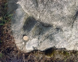
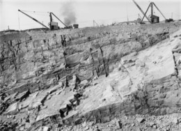
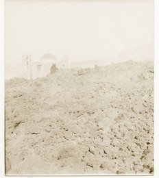
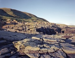
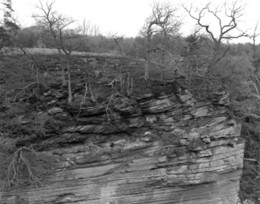
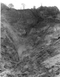
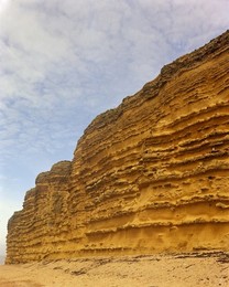
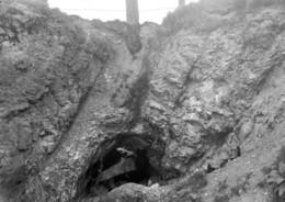
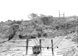
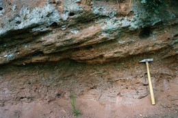
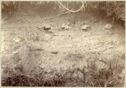
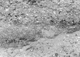
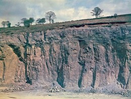
| Caption: | Northern part of Amey's Eartham Pit, Boxgrove Common, near Chichester. |
| Description: | Northern part of Amey's Eartham Pit, Boxgrove Common, near Chichester. Decalcification of 'channel fill' deposits. Close-up of water-lain chalky flint gravels with brownish silt layers affected by progressive downward decalcification. This has resulted in the loss of chalk pebbles and hence volume so that the red brown flinty clay residue has collapsed in the decalcified area. The channels are cut into the raised beach deposits ('Slindon Sands'). Shovel approx. 0.9 m. |
| Date taken: | Thu Oct 01 00:00:00 BST 1981 |
| Photographer: | Collins, R.E. |
| Copyright statement: | NERC |
| X longitude/easting: | 492500 |
| Y latitude/northing: | 108500 |
| Coordinate reference system, ESPG code: | 27700 (OSGB 1936 / British National Grid) |
| Orientation: | Landscape |
| Size: | 356.71 KB; 1000 x 666 pixels; 85 x 56 mm (print at 300 DPI); 265 x 176 mm (screen at 96 DPI); |
| Average Rating: | Not yet rated |
| Categories: | Unsorted Images |
Loading...
Loading...
Reviews
There is currently no feedback