Advanced Search
Advanced Search
0
My Lightbox
Expand view
Log In
Register
Home
Advanced Search
Browse
Lightbox
Map-Based Search
Get Help
Browse by Popularity
Least Viewed Items
Least Viewed Items
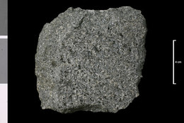
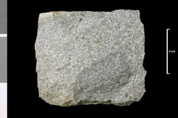
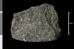
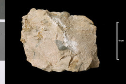
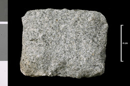
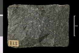
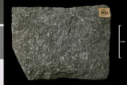
P1006426
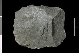
Granite. 300 yards E 30 deg N of exit...
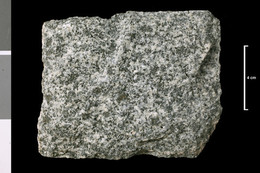
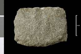
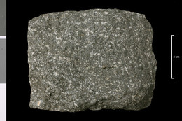
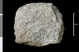
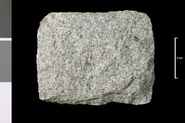
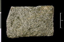
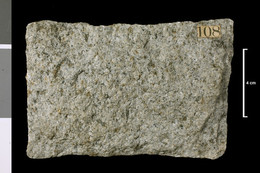
P1006428
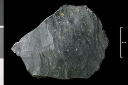
Granite. White Hill. 760 yards W 15 deg...
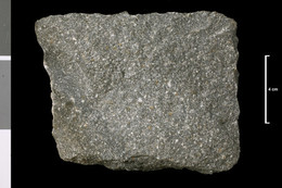
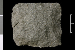
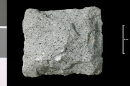
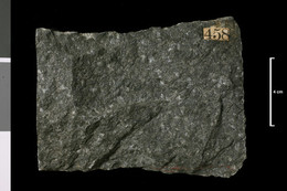
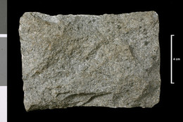
P1006435
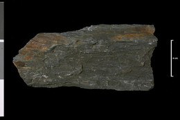
Porphyrite. Dyke. 800 yards WSW of...
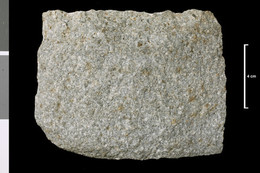
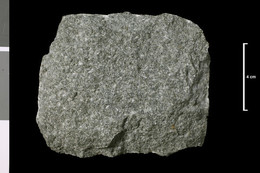
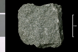
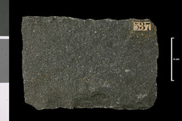
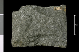
P1006437
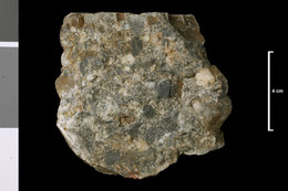
Porphyrite. Dyke, 9 ft wide. 1100 yards...
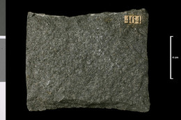
P1006445
Porphyrite. Dyke, 8 - 9 ft wide. Summit...
P1006446
Porphyrite. Dyke, 8 - 9 ft wide. 1230...
P1006449
Porphyrite. Dyke, 18 ft wide. 800 yards...
P1006450
Porphyrite. Dyke. 900 yards E 30 deg N...
P1006451
Porphyrite. Dyke, 15 ft wide. 300 yards...
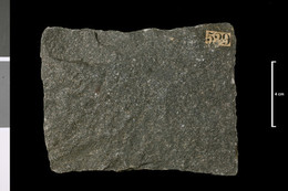
P1006453
Porphyrite. Dyke, 25 - 30 ft wide. 50...
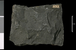
P1006454
?Porphyrite. Dyke, 6 - 9 ft wide. 500...
P1006457
Lamprophyre. Dyke, 15 - 18 ft wide....
P1006458
Felsite. Dyke, 6 ft wide. Polmaddy...
P1006463
Porphyrite. Dyke, 9 ft wide. 430 yards...
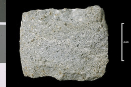
P1006465
Granite. Dyke, 10 - 12 ft wide....
P1006470
Porphyrite. Dyke, 10 - 12 ft wide. 1860...
P1006473
Lamprophyre. Dyke. 1330 yards ENE of...
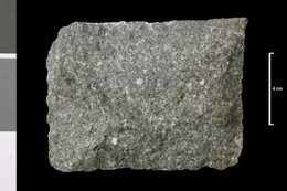
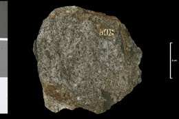
P1006499
Granite. Mass. Knockgray, 1450 yds N 30...
P1006500
Granite. Mass. Knockgray, 1450 yds N 30...
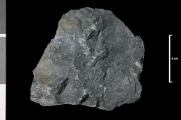
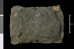
P1006504
Shale of greywacke. Sedimentary rocks...
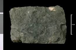
P1006505
Shale of greywacke. Sedimentary rocks...
P1006506
Shale of greywacke. Sedimentary rocks...
P1006512
Tunnel from Carsphairn Lane to Loch...
P1006521
0.5 mile N of Talnotry, Palnure Burn. .
P1006522
Conglomerate, baked. Caradoc. W slope...
P1006523
Greywacke, hornfelsed. Moorbrack Gairy,...
P1006524
Greywacke, hornfelsed. Dunool Hill, 2.5...
P1006525
Greywacke, hornfelsed. S of Meaul Hill,...
P1006526
Mica hornfels. Head of Downie's Burn, 5...
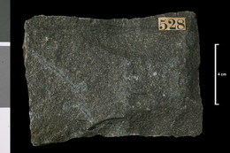
P1006528
Greywacke, metamorphosed. Polmeadow...
P1006529
Greywacke, shaly, hornfelsed. Buchan...
P1006531
Metamorphosed pebbly greywacke. Meike...
P1006532
Altered lava?. ?Arenig. Hill slope, W...
P1006540
Hornblende granitie. Vein. Head of...
P1006542
Dyke crossing footpath, 3 miles S of...
P1006543
Ridge, head of Cardorkan Burn, 4.5...
P1006544
Top of Craigrine Hill, 5 miles SSW of...
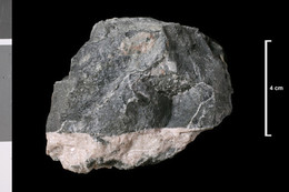
P1006545
Dolerite or diorite. Contact...
P1006546
Porphyrite. Dyke. W slope of Meaul...
P1006547
Porphyrite. Gairy Hill Top, 1.5 miles S...