| P number: | P210257 |
|---|---|
| Old photograph number: | A10356 |
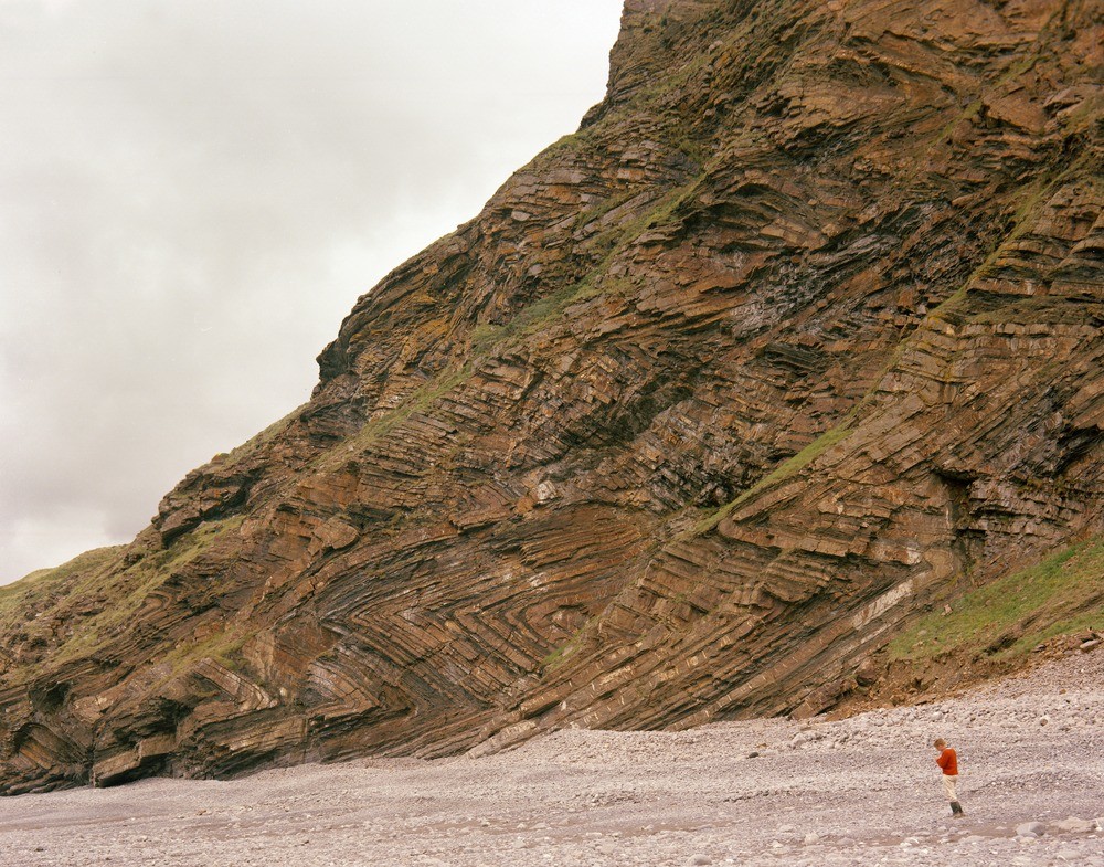
| Caption: | Millook Haven, 8 3/4 m. NE of Boscastle. Looking E. |
| Description: | Millook Haven, 8 3/4 m. NE of Boscastle. Looking E. Folding in greywacke-type sandstones and shales of the Crackington Measures (Middle Culm). The axial planes of the folds are flat-lying or dipping north at very gentle angles. The longest limbs dip to the north at about 30 degrees and are very overturned. In the extreme lower left part of the picture a low-angle fault dipping to the north can be seen displacing a thick sandstone normally. |
| Date taken: | Fri Jan 01 00:00:00 GMT 1965 |
| Photographer: | Pulsford, J.M. |
| Copyright statement: | NERC |
| X longitude/easting: | 218500 |
| Y latitude/northing: | 100500 |
| Coordinate reference system, ESPG code: | 27700 (OSGB 1936 / British National Grid) |
| Orientation: | Landscape |
| Size: | 345.40 KB; 1000 x 785 pixels; 85 x 66 mm (print at 300 DPI); 265 x 208 mm (screen at 96 DPI); |
| Average Rating: | Not yet rated |
| Categories: | Unsorted Images, Geoscience subjects/ Structural features/ Folding |
Loading...
Loading...
Reviews
There is currently no feedback