| P number: | P222388 |
|---|---|
| Old photograph number: | L01572 |
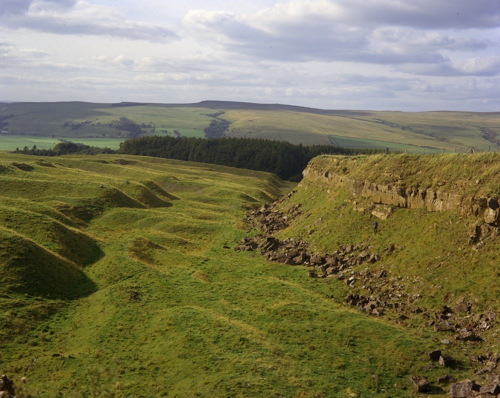
| Caption: | Ridsdale Ironstone Workings. Looking NNW. |
| Description: | Ridsdale Ironstone Workings. Looking NNW. The quarry face is formed largely by the Redesdale Limestone and underlying sandstone. (Boundary of the Upper Border Group/Lower Liddesdale Group.) The grassed area of face once exposed the Redesdale Ironstone Shale which was dug for the ironstone nodules it contained. The tips to the left are the spoil heaps of shale which remain after the ironstones have been removed. Rede Valley in the distance. |
| Date taken: | Tue Oct 01 00:00:00 BST 1974 |
| Photographer: | Thornton, K.E. |
| Copyright statement: | NERC |
| X longitude/easting: | 388930 |
| Y latitude/northing: | 584150 |
| Coordinate reference system, ESPG code: | 27700 (OSGB 1936 / British National Grid) |
| Orientation: | Landscape |
| Size: | 268.88 KB; 1000 x 797 pixels; 85 x 67 mm (print at 300 DPI); 265 x 211 mm (screen at 96 DPI); |
| Average Rating: | Not yet rated |
| Categories: | Unsorted Images, Geoscience subjects/ Economic geology/ Metalliferous mining, ironstone, opencast |
Loading...
Loading...
Reviews
There is currently no feedback