| P number: | P209986 |
|---|---|
| Old photograph number: | A10081 |
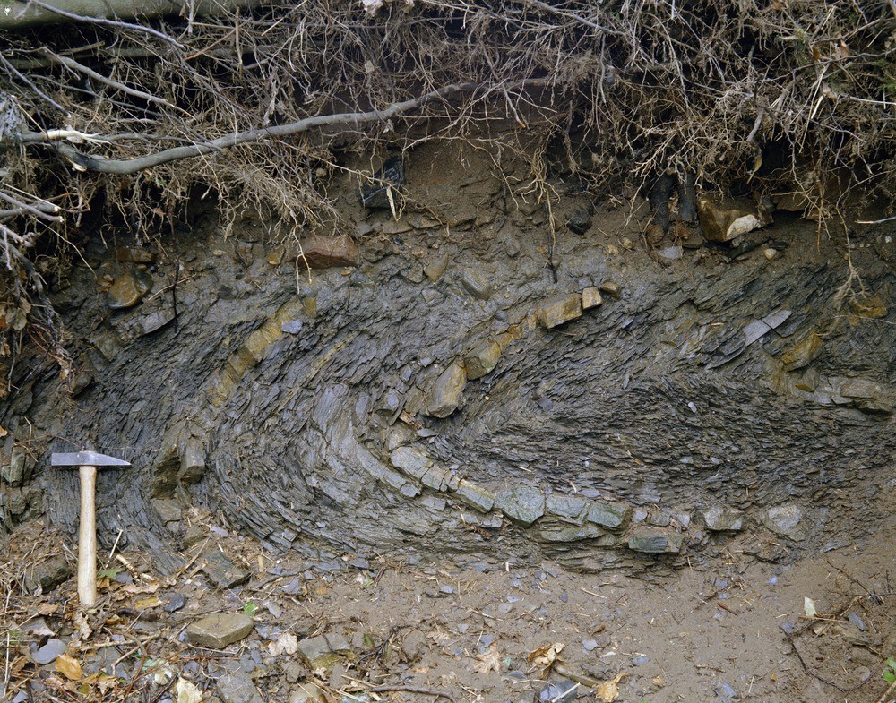
| Caption: | E. bank of River Taw, immediately N. of North Tawton Railway Viaduct. Looking from W. |
| Description: | E. bank of River Taw, immediately N. of North Tawton Railway Viaduct. Looking from W. Fold in Middle Culm Measures. Middle Culm Measures shales with thin turbidite sandstones in horizontal fold under alluvium with gravelly base. Drag marks on the sandstones show the beds younging away from the fold core. |
| Date taken: | Tue Jan 01 00:00:00 GMT 1963 |
| Photographer: | Pulsford, J.M. |
| Copyright statement: | Crown |
| X longitude/easting: | 265500 |
| Y latitude/northing: | 100500 |
| Coordinate reference system, ESPG code: | 27700 (OSGB 1936 / British National Grid) |
| Orientation: | Landscape |
| Size: | 446.29 KB; 1000 x 785 pixels; 85 x 66 mm (print at 300 DPI); 265 x 208 mm (screen at 96 DPI); |
| Average Rating: | Not yet rated |
| Categories: | Unsorted Images, Geoscience subjects/ Structural features/ Folding |
Loading...
Loading...
Reviews
There is currently no feedback