| P number: | P001195 |
|---|---|
| Old photograph number: | D04967 |
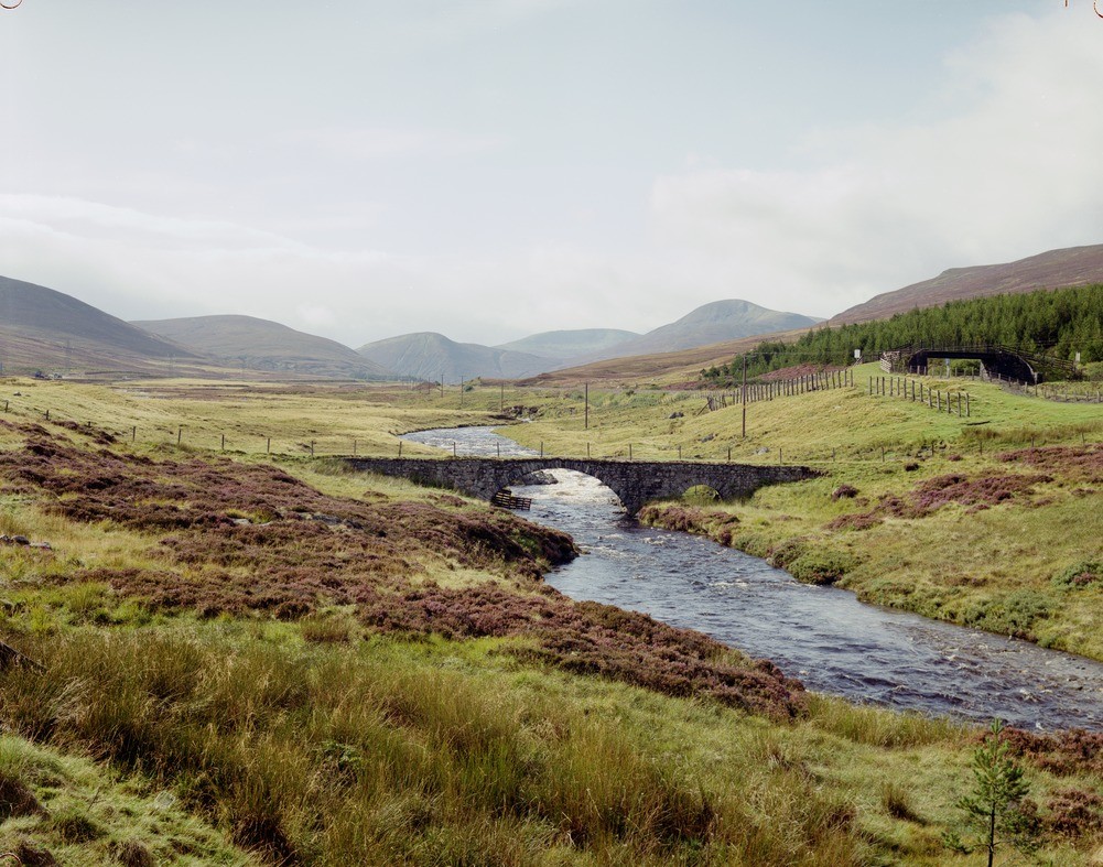
| Caption: | River Truim, south of Dalwhinnie Village. Inverness-shire. View looking south. Dalradian Grampian Group country. |
| Description: | River Truim, south of Dalwhinnie Village. Inverness-shire. View looking south. Dalradian Grampian Group country. In the distance are the rounded peat-covered Drumochter Hills, formed of Grampian Group psammites. General Wade's Military Bridge spans the River Truim with its alluvial plain and glacial deposits. The A9 road is on the left. |
| Date taken: | Wed Jan 01 00:00:00 GMT 1992 |
| Photographer: | McTaggart, F.I. |
| Copyright statement: | NERC |
| Acknowledgment: | This image was digitized with grant-in-aid from SCRAN the Scottish Cultural Resources Access Network |
| X longitude/easting: | 263280 |
| Y latitude/northing: | 783270 |
| Coordinate reference system, ESPG code: | 27700 (OSGB 1936 / British National Grid) |
| Orientation: | Landscape |
| Size: | 267.20 KB; 1001 x 787 pixels; 85 x 67 mm (print at 300 DPI); 265 x 208 mm (screen at 96 DPI); |
| Average Rating: | Not yet rated |
| Categories: | Best of BGS Images/ Landscapes |
Loading...
Loading...
Reviews
There is currently no feedback