| P number: | P243001 |
|---|---|
| Old photograph number: | MNS04272 |
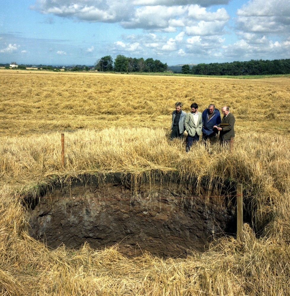
| Caption: | 130 m. E. of Rosewell Manse, Rosewell. |
| Description: | Subsidence hole 5 m. diameter, 2 m. deep. Possible 'crown hole' over workings in Whitehill Great Seam; profile: soil 0.3m, 'Roslin Till' 0.5 to 0.8m, sand o.3+. Subsidence type earth tremors on 3rd August (mag:109, locn:NT293626, depth:0.5km) and 21st August (mag:2.5, locn:NT294626, depth:0.1km) may have played a part in causing and modifying the hole. It was reportedly discovered shortly after the first event and was foundto have been widened but shallowed after the second. |
| Date taken: | Wed Jan 01 00:00:00 GMT 1986 |
| Photographer: | Unknown |
| Copyright statement: | Unknown |
| X longitude/easting: | 329470 |
| Y latitude/northing: | 663200 |
| Coordinate reference system, ESPG code: | 27700 (OSGB 1936 / British National Grid) |
| Orientation: | Portrait |
| Size: | 486.01 KB; 980 x 1000 pixels; 83 x 85 mm (print at 300 DPI); 259 x 265 mm (screen at 96 DPI); |
| Average Rating: | Not yet rated |
| Categories: | Best of BGS Images/ Geological hazards |
Loading...
Loading...
Reviews
There is currently no feedback