| P number: | P211750 |
|---|---|
| Old photograph number: | A12213 |
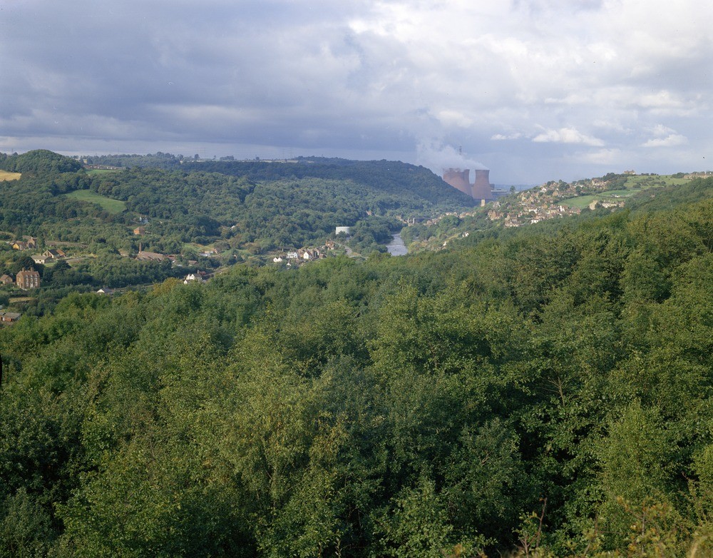
| Caption: | Lloyd's Coppice, Telford. Looking W. |
| Description: | Lloyd's Coppice, Telford. Looking W. Ironbridge Gorge from Lloyd's Coppice. View upstream looking out over Lloyd's Coppice, an area of landslips in the Coalport Formation. The villages of Ironbridge (right), Ladywood and Jackfield (left) are situated on the productive Lower Coal Measures, and between Ironbridge and the Buildwas Power Station the Wenlock Limestone forms a feature either side of the gorge. |
| Date taken: | Tue Jan 01 00:00:00 GMT 1974 |
| Photographer: | Evans, H.J. |
| Copyright statement: | NERC |
| X longitude/easting: | 369110 |
| Y latitude/northing: | 303240 |
| Coordinate reference system, ESPG code: | 27700 (OSGB 1936 / British National Grid) |
| Orientation: | Landscape |
| Size: | 300.08 KB; 1000 x 782 pixels; 85 x 66 mm (print at 300 DPI); 265 x 207 mm (screen at 96 DPI); |
| Average Rating: | Not yet rated |
| Categories: | Unsorted Images, Geoscience subjects/ Named locality |
Loading...
Loading...
Reviews
There is currently no feedback