| P number: | P002238 |
|---|---|
| Old photograph number: | C02035 |
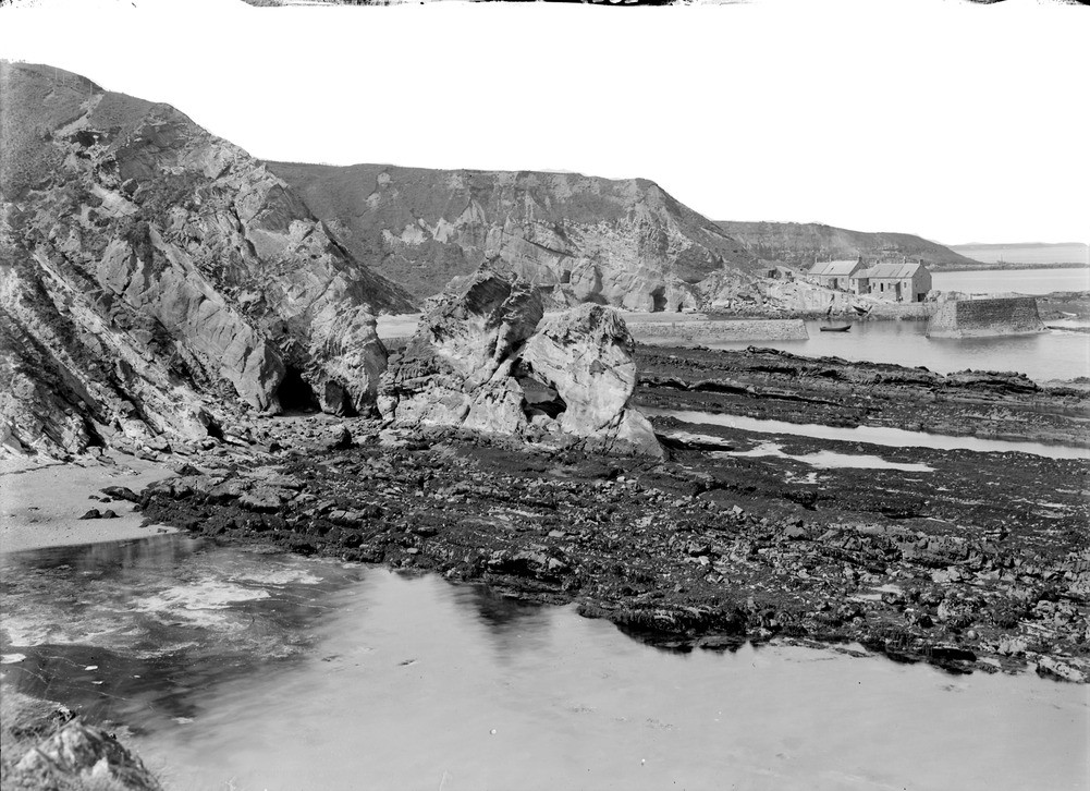
| Caption: | South side of Cove Harbour, 1.1 km. north-east of Cockburnspath, Berwickshire. |
| Description: | The lithologies and fauna of the Calciferous Sandstone Measures indicate that they were deposited in a deltaic or fluvial environment with a few marine incursions. An isolated stack with a arch is in the centre of the photograph sitting on a wave-cut platform. The buildings and harbour mouth of Cove can be seen in the background. Beds of Carboniferous Calciferous Sandstone Measures in the foreground dipping steeply north away from the Cove fault. On shore, these have been cut down into a plain of marine denudation. |
| Date taken: | Thu Jan 01 00:00:00 GMT 1914 |
| Photographer: | Lunn, R. |
| Copyright statement: | Crown |
| Acknowledgment: | This image was digitized with grant-in-aid from SCRAN the Scottish Cultural Resources Access Network |
| X longitude/easting: | 378500 |
| Y latitude/northing: | 671500 |
| Coordinate reference system, ESPG code: | 27700 (OSGB 1936 / British National Grid) |
| Orientation: | Landscape |
| Size: | 241.74 KB; 1001 x 726 pixels; 85 x 61 mm (print at 300 DPI); 265 x 192 mm (screen at 96 DPI); |
| Average Rating: | Not yet rated |
| Categories: | Unsorted Images, Geoscience subjects/ Stratigraphical |
Loading...
Loading...
Reviews
There is currently no feedback