| P number: | P204070 |
|---|---|
| Old photograph number: | A04122 |
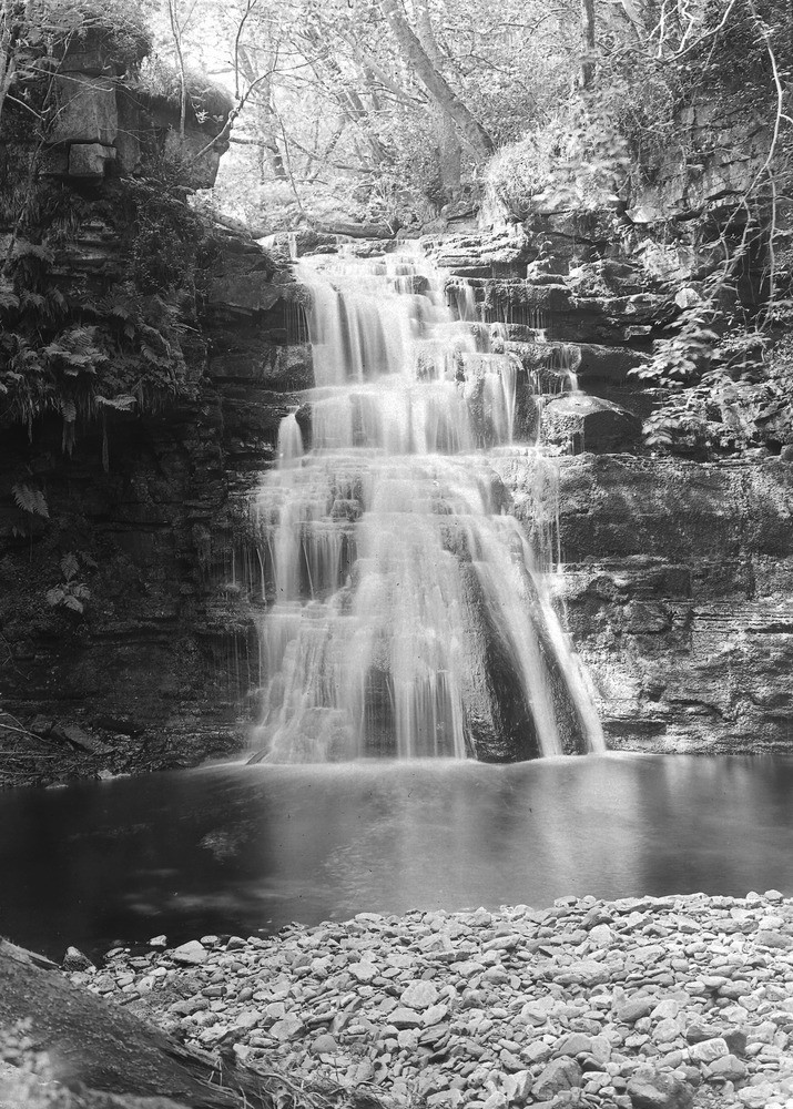
| Caption: | Waterfall, Glendue Burn, 150 yd. below Alston Road, about 1 1/4 m. S. of Lambley Station. Looking W. |
| Description: | Waterfall, Glendue Burn, 150 yd. below Alston Road, about 1 1/4 m. S. of Lambley Station. Looking W. Waterfall over Carboniferous Sandstone. The top of the fall is a hard ganistery sandstone lying above the Lower Oakwood Limestone of the Upper Limestone Group. The pool is in soft shales. |
| Date taken: | Wed Jun 01 00:00:00 BST 1927 |
| Photographer: | Rhodes, J. |
| Copyright statement: | Crown |
| X longitude/easting: | 367353 |
| Y latitude/northing: | 556486 |
| Coordinate reference system, ESPG code: | 27700 (OSGB 1936 / British National Grid) |
| Orientation: | Portrait |
| Size: | 319.14 KB; 715 x 1000 pixels; 61 x 85 mm (print at 300 DPI); 189 x 265 mm (screen at 96 DPI); |
| Average Rating: | Not yet rated |
| Categories: | Unsorted Images, Geoscience subjects/ Landforms, river/ Waterfalls and pot-holes |
Loading...
Loading...
Reviews
There is currently no feedback