| P number: | P202565 |
|---|---|
| Old photograph number: | A02617 |
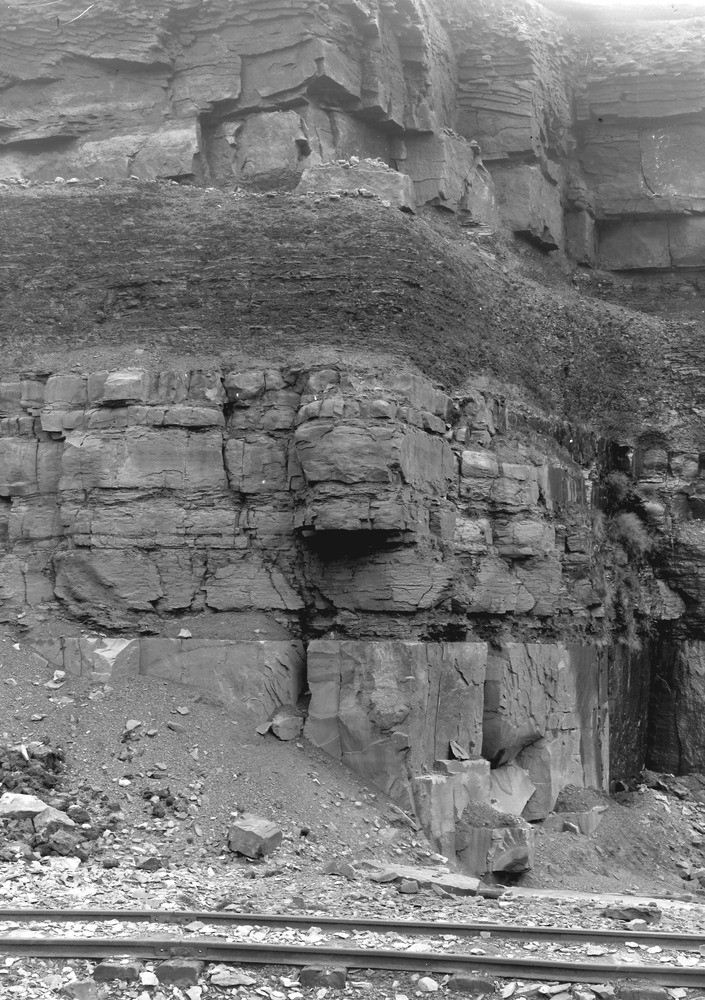
| Caption: | Scout Moor Quarries, 1 m. E. of Edenfield. Looking E. |
| Description: | Scout Moor Quarries, 1 m. E. of Edenfield. Looking E. Millstone Grit. Rough Rock is seen at the top of the face, and is separated by dark shales from the Haslingden Flags below. The lowest bed is a massive freestone ('lonkey') and is worked for setts, etc. The Rough Rock is now crushed for sand. |
| Date taken: | Sat Sep 01 00:00:00 BST 1923 |
| Photographer: | Rhodes, J. |
| Copyright statement: | Crown |
| X longitude/easting: | 381500 |
| Y latitude/northing: | 419500 |
| Coordinate reference system, ESPG code: | 27700 (OSGB 1936 / British National Grid) |
| Orientation: | Portrait |
| Size: | 293.44 KB; 705 x 1000 pixels; 60 x 85 mm (print at 300 DPI); 187 x 265 mm (screen at 96 DPI); |
| Average Rating: | Not yet rated |
| Categories: | Unsorted Images, Geoscience subjects/ Economic geology/ Building stones, sandstone, Geoscience subjects/ Sedimentary features/ Bedding, Geoscience subjects/ Structural features/ Stratification |
Loading...
Loading...
Reviews
There is currently no feedback