| P number: | P002241 |
|---|---|
| Old photograph number: | C02046 |
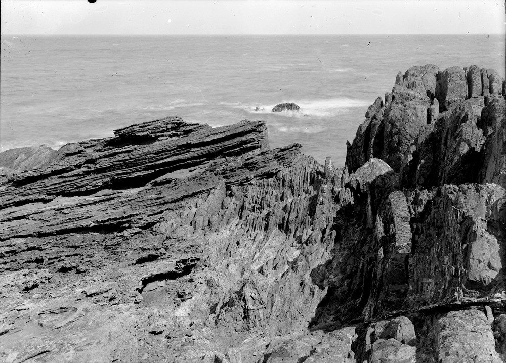
| Caption: | Siccar Point, 4.0 km. east of Cockburnspath, Berwickshire. Hutton's Unconformity. |
| Description: | Siccar Point, 4.0 km. east of Cockburnspath, Berwickshire. Hutton's Unconformity. Unconformable junction of gently-dipping sandstones of the Stratheden Group (Upper Old Red Sandstone) at (A), on near-vertical greywackes of the Silurian Gala Group at (B). The angular unconformity demonstrates that a long period of folding, uplift and erosion had taken place between the deposition of the underlying Silurian rocks and that of the overlying Devonian sandstones. Siccar Point is one of the most important and best-known geological sites in Scotland. It has great historical significance as the locality where, in 1788, James Hutton, accompanied by John Playfair and Sir James Hall, first appreciated the very long timescale represented by geological processes. |
| Date taken: | Thu Jan 01 00:00:00 GMT 1914 |
| Photographer: | Lunn, R. |
| Copyright statement: | Crown |
| Acknowledgment: | This image was digitized with grant-in-aid from SCRAN the Scottish Cultural Resources Access Network |
| X longitude/easting: | 381500 |
| Y latitude/northing: | 670500 |
| Coordinate reference system, ESPG code: | 27700 (OSGB 1936 / British National Grid) |
| Orientation: | Landscape |
| Size: | 276.23 KB; 1000 x 718 pixels; 85 x 61 mm (print at 300 DPI); 265 x 190 mm (screen at 96 DPI); |
| Average Rating: | Not yet rated |
| Categories: | Best of BGS Images/ Images from the archives, Geoscience subjects/ Structural features/ Unconformities and junction planes between beds of different age |
Loading...
Loading...
Reviews
There is currently no feedback