| P number: | P002361 |
|---|---|
| Old photograph number: | C02504 |
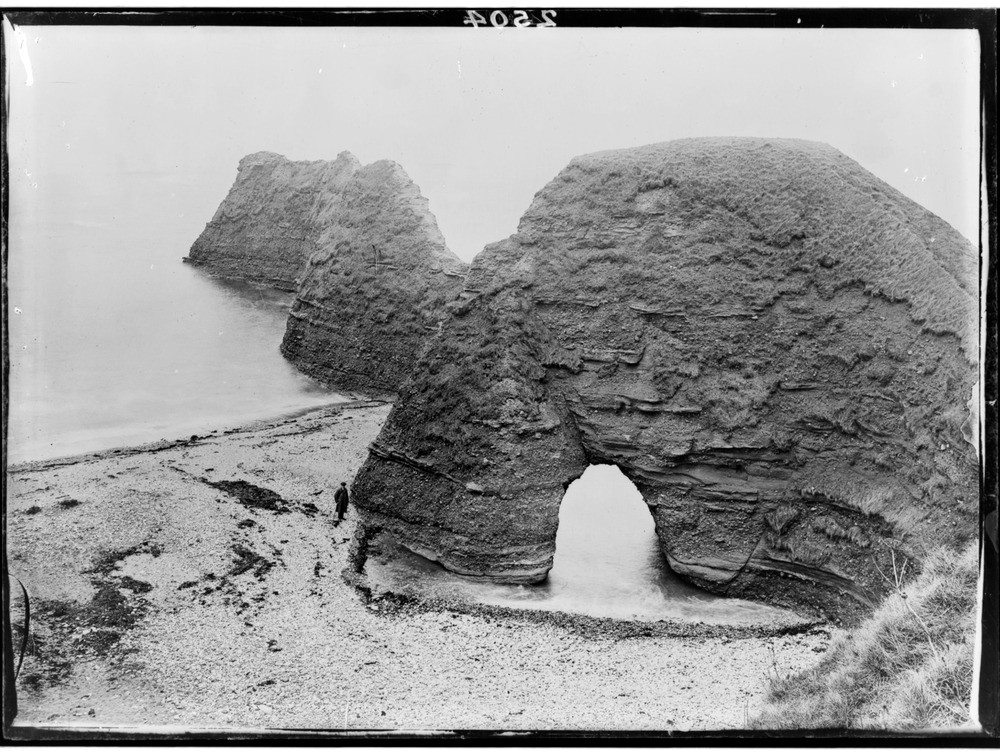
| Caption: | Coast, 2.4 km. north-east of Arbroath, Angus. An arch formed in Upper Old Red Sandstone conglomerate driven along the line of a fault which has evidently determined the south side of the headland. |
| Description: | Coast, 2.4 km. north-east of Arbroath, Angus. An arch formed in Upper Old Red Sandstone conglomerate driven along the line of a fault which has evidently determined the south side of the headland. The effect of marine erosion along the fault has given rise to both the arch and the stacks beyond. The lack of joints in the Upper Old Red Sandstone and the different lithology has produced a completely different more rounded form to the coast compared to the strongly jointed Lower Old Red Sandstone cliffs seen in C02491 and C02492. |
| Date taken: | Wed Jan 01 00:00:00 GMT 1919 |
| Photographer: | Lunn, R. |
| Copyright statement: | Crown |
| Acknowledgment: | This image was digitized with grant-in-aid from SCRAN the Scottish Cultural Resources Access Network |
| X longitude/easting: | 366500 |
| Y latitude/northing: | 741500 |
| Coordinate reference system, ESPG code: | 27700 (OSGB 1936 / British National Grid) |
| Orientation: | Landscape |
| Size: | 263.08 KB; 1000 x 756 pixels; 85 x 64 mm (print at 300 DPI); 265 x 200 mm (screen at 96 DPI); |
| Average Rating: | Not yet rated |
| Categories: | Unsorted Images, Geoscience subjects/ Landforms, marine/ Natural arches |
Loading...
Loading...
Reviews
There is currently no feedback