| P number: | P222468 |
|---|---|
| Old photograph number: | L01658 |
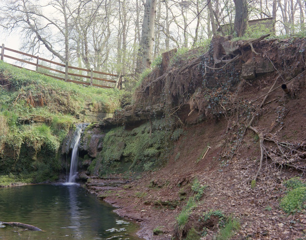
| Caption: | Waterfall in stream in Lower Brookfarm Dumble, Snelston, Derbyshire. |
| Description: | Waterfall formed by bed of hard pebbly sandstone in Denstone Siltstones Formation, stream in Lower Brookfarm Dumble, Snelston. Looking south. Section shows the pebbly sandstone bed forming the lip of the waterfall, and overlying silty mudstones with occasional very thin beds of siltstone and fine sandstone often with ripple-marked surfaces. The pebbly sandstone is in turn overlain by very thinly-bedded fine sandstone and sandy siltstone. The beds form part of the Denstone Siltstones Formation, the local basal division of the Mercia Mudstone Group of Triassic age. The formation consists of a succession of mainly red-brown siltstones, thinly interlayered with subordinate fine-grained sandstones and mudstones. It is characterized by the presence of ripple-marked surfaces, mica-covered bedding-planes, pseudomorphs after halite, calcite-encrusted vugs and mudcracks. For the most part these rocks are thinly bedded, though poorly bedded, homogenous or 'structureless' parts occur. The siltstone and sandstone beds are well cemented in part, mostly by calcite or less commonly by baryte or dolomite; gypsum occurs in places as thin beds or as small nodules. |
| Date taken: | Wed Sep 01 00:00:00 BST 1976 |
| Photographer: | Thornton, K.E. |
| Copyright statement: | NERC |
| X longitude/easting: | 415950 |
| Y latitude/northing: | 342380 |
| Coordinate reference system, ESPG code: | 27700 (OSGB 1936 / British National Grid) |
| Orientation: | Landscape |
| Size: | 377.97 KB; 1000 x 787 pixels; 85 x 67 mm (print at 300 DPI); 265 x 208 mm (screen at 96 DPI); |
| Average Rating: | Not yet rated |
| Categories: | Unsorted Images, Geoscience subjects/ Landforms, river/ Waterfalls and pot-holes |
Loading...
Loading...
Reviews
There is currently no feedback