| P number: | P002189 |
|---|---|
| Old photograph number: | C01920 |
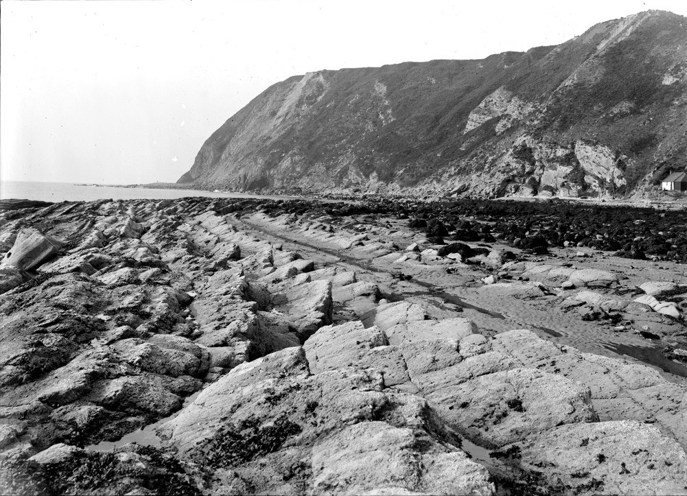
| Caption: | Port an Righ, 4.8 km. south-south-east of Hill of Fearn, Ross & Cromarty. Wave-cut platform in Jurassic sandstones and shales. Looking south. |
| Description: | Port an Righ, 4.8 km. south-south-east of Hill of Fearn, Ross & Cromarty. Wave-cut platform in Jurassic sandstones and shales. Looking south. The Jurassic sandstones and shales in this area and further south at Ethie are one of the notable geological features of north-east Scotland. They are of Upper Oxfordian to Corallian in age and are faulted down against Middle Old Red Sandstone beds in the cliff behind, the dip of the Jurassic rocks being away from the fault. The cliff has a thick covering of boulder clay. |
| Date taken: | Wed Jan 01 00:00:00 GMT 1913 |
| Photographer: | Lunn, R. |
| Copyright statement: | Crown |
| Acknowledgment: | This image was digitized with grant-in-aid from SCRAN the Scottish Cultural Resources Access Network |
| X longitude/easting: | 285500 |
| Y latitude/northing: | 873500 |
| Coordinate reference system, ESPG code: | 27700 (OSGB 1936 / British National Grid) |
| Orientation: | Landscape |
| Size: | 301.76 KB; 1001 x 723 pixels; 85 x 61 mm (print at 300 DPI); 265 x 191 mm (screen at 96 DPI); |
| Average Rating: | Not yet rated |
| Categories: | Unsorted Images, Geoscience subjects/ Stratigraphical, Geoscience subjects/ Landforms, marine/ Wave-cut platforms, reefs and foreshores |
Loading...
Loading...
Reviews
There is currently no feedback