| P number: | P000867 |
|---|---|
| Old photograph number: | D02494 |
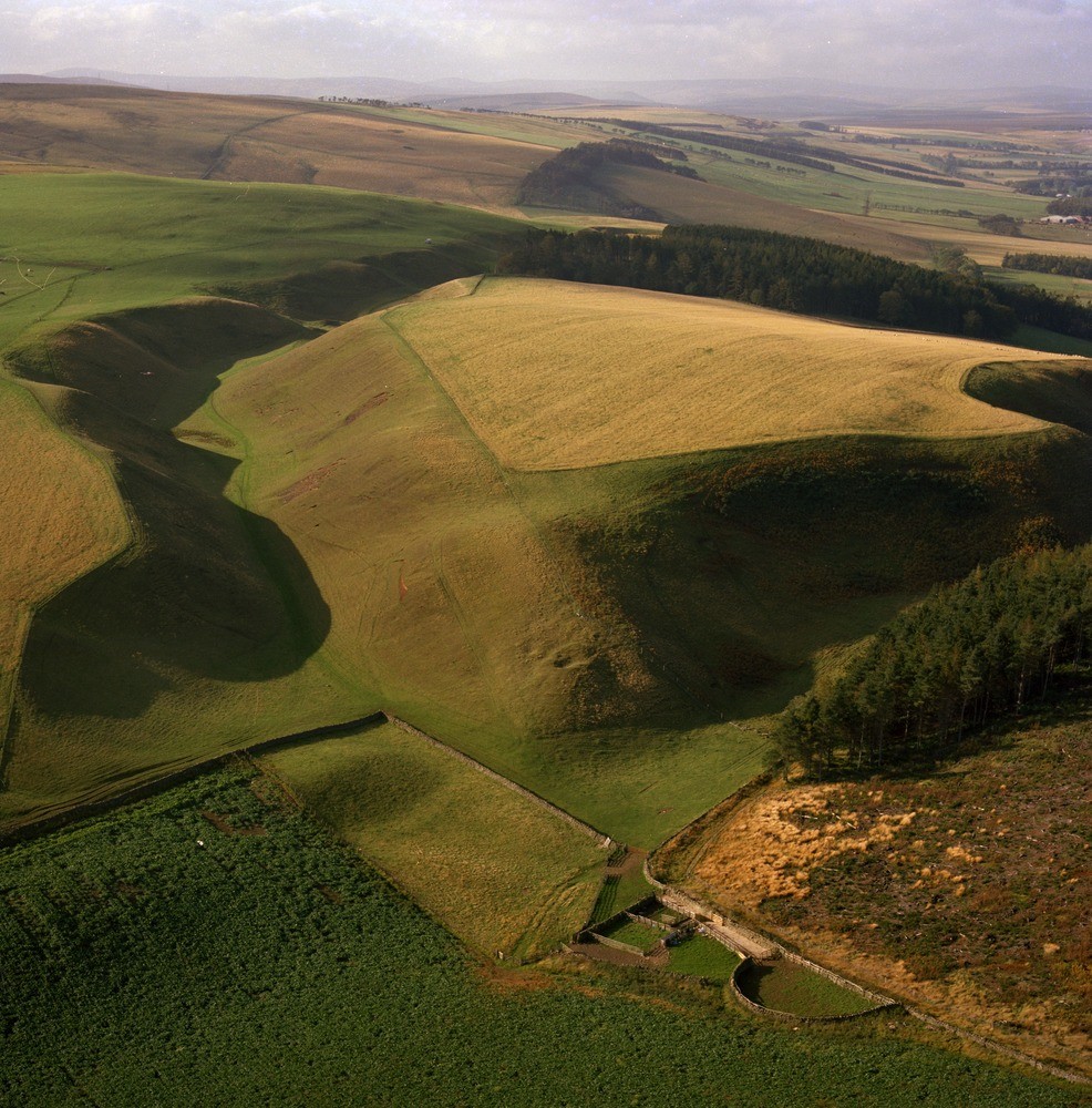
| Caption: | North slopes of Lammermuir Hills 1.5 km. east-north-east of Blegbie Farm. East Lothian. View looking south-west. Glacial drainage channels. A prominent channel is seen extending from the central middle distance to the left foreground. |
| Description: | North slopes of Lammermuir Hills 1.5 km. east-north-east of Blegbie Farm. East Lothian. View looking south-west. Glacial drainage channels. A prominent channel is seen extending from the central middle distance to the left foreground. The water flow in the channel was from south-west to north-east. The mouth of another prominent channel is seen in the right foreground. Both channels are cut in Ordovician greywackes and shales. During deglaciation as the climate improved, the ice retreated and melted leaving ice-free ground along the slopes of the Lammermuir Hills. Large volumes of glacial meltwater were released to cut numerous glacial meltwater channels. Ice lying in the low ground blocked the river valleys, so damming the meltwaters which were forced to cut new channels along the ice margin and across cols into other valleys. |
| Date taken: | Sat Jan 01 00:00:00 GMT 1977 |
| Photographer: | Christie, A. |
| Copyright statement: | NERC |
| Acknowledgment: | This image was digitized with grant-in-aid from SCRAN the Scottish Cultural Resources Access Network |
| X longitude/easting: | 349700 |
| Y latitude/northing: | 662300 |
| Coordinate reference system, ESPG code: | 27700 (OSGB 1936 / British National Grid) |
| Orientation: | Portrait |
| Size: | 334.75 KB; 986 x 1000 pixels; 83 x 85 mm (print at 300 DPI); 261 x 265 mm (screen at 96 DPI); |
| Average Rating: | Not yet rated |
| Categories: | Best of BGS Images/ Landscapes |
Loading...
Loading...
Reviews
There is currently no feedback