| P number: | P000389 |
|---|---|
| Old photograph number: | C01450 |
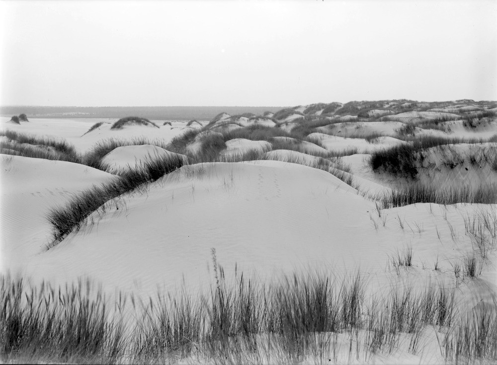
| Caption: | Maviston sand-hills. Morayshire. Sand-dunes. Arrest of drifting sand by tufts of bent and marram grass. The direction of drift is towards observer, i.e. from west to east. |
| Description: | Maviston sand-hills. Morayshire. Sand-dunes. Arrest of drifting sand by tufts of bent and marram grass. The direction of drift is towards observer, i.e. from west to east. An accepted method of stabilizing the dunes was the planting of marram grass, a tough long-stemmed grass which spreads long roots under the surface. Root clusters form, new leaves propagate to the surface to form thick clumps of sturdy grass with interconnected root systems. At Maviston, it was reported by the Geological Survey that there were two dome-shaped masses one rising to a height of seventy feet and the other about forty feet. The western slope averages about 5 degrees and the eastern reaches an angle of 30 degrees in places. |
| Date taken: | Sat Jan 01 00:00:00 GMT 1910 |
| Photographer: | Lunn, R. |
| Copyright statement: | Crown |
| Acknowledgment: | This image was digitized with grant-in-aid from SCRAN the Scottish Cultural Resources Access Network |
| X longitude/easting: | 293500 |
| Y latitude/northing: | 859500 |
| Coordinate reference system, ESPG code: | 27700 (OSGB 1936 / British National Grid) |
| Orientation: | Landscape |
| Size: | 157.29 KB; 1000 x 735 pixels; 85 x 62 mm (print at 300 DPI); 265 x 194 mm (screen at 96 DPI); |
| Average Rating: | Not yet rated |
| Categories: | Best of BGS Images/ Images from the archives |
Loading...
Loading...
Reviews
There is currently no feedback