| P number: | P007179 |
|---|---|
| Old photograph number: | L01869 |
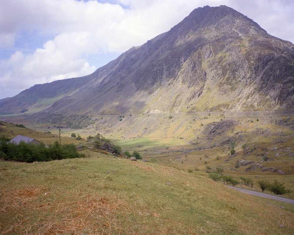
| Caption: | 500 m. SE of Blaen-y-nant, Nant Ffrancon. Looking NE. |
| Description: | 500 m. SE of Blaen-y-nant, Nant Ffrancon. Looking NE. South-west ridge and western face of Pen-yr Ole Wen. Steeply-dipping middle Ordovician sandstones form the peak and the ridge to the right. The underlying Capel Curig Volcanic Formation (centre) is intruded by a thick (c. 100 m.) dolerite sill (centre left). On the extreme right of the picture the Pitts Head Ignimbrite is exposed in the core of the steeply plunging Idwal syncline. |
| Date taken: | Wed May 01 00:00:00 BST 1974 |
| Photographer: | Thornton, K.E. |
| Copyright statement: | NERC |
| Acknowledgment: | This image was digitized with grant-in-aid from JIDI the JISC Image Digitization Initiative |
| X longitude/easting: | 264400 |
| Y latitude/northing: | 360320 |
| Coordinate reference system, ESPG code: | 27700 (OSGB 1936 / British National Grid) |
| Orientation: | Landscape |
| Size: | 269.97 KB; 1000 x 799 pixels; 85 x 68 mm (print at 300 DPI); 265 x 211 mm (screen at 96 DPI); |
| Average Rating: | Not yet rated |
| Categories: | Unsorted Images, Geoscience subjects/ Landforms, mountains and hills |
Loading...
Loading...
Reviews
There is currently no feedback