| P number: | P001288 |
|---|---|
| Old photograph number: | D05499 |
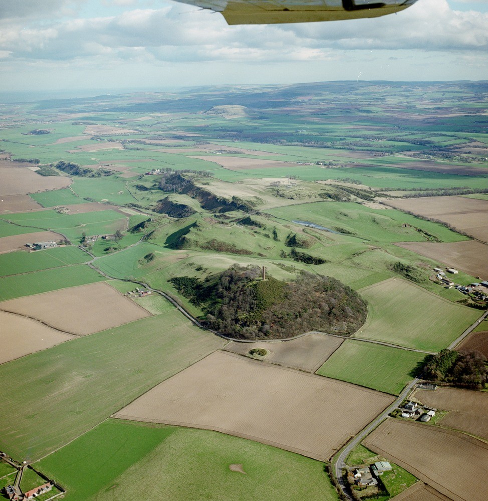
| Caption: | Oblique aerial view of Hopetoun Monument, Skid Hill, Garleton Hills, Traprain Law, and Lammermuir Hills, looking from the west-north-west. |
| Description: | Oblique aerial view of Hopetoun Monument, Skid Hill, Garleton Hills, Traprain Law, and Lammermuir Hills, looking from the west-north-west. Very fine trap featuring of south-dipping trachyte lavas of the Lower Carboniferous Garleton Hills Volcanic Formation. Lower basaltic lavas form scarps in top left. The features have been increased by the effects of glaciation and meltwater channels. The lower arable ground is covered by glacial till and other superficial deposits. The hump-shaped hill of Traprain Law, far mid left, is an exhumed laccolith of phonolite, also Garleton Hills Volcanic Rocks age. The rounded Lammermuir Hills on the skyline, lying across the Southern Upland Fault, consist of Ordovician and Silurian folded greywackes and shales of the Southern Upland Terrane. |
| Date taken: | Wed May 01 00:00:00 BST 1996 |
| Photographer: | Bain, T.S. |
| Copyright statement: | NERC |
| Acknowledgment: | This image was digitized with grant-in-aid from SCRAN the Scottish Cultural Resources Access Network |
| X longitude/easting: | 349800 |
| Y latitude/northing: | 676000 |
| Coordinate reference system, ESPG code: | 27700 (OSGB 1936 / British National Grid) |
| Orientation: | Portrait |
| Size: | 298.15 KB; 974 x 1000 pixels; 82 x 85 mm (print at 300 DPI); 258 x 265 mm (screen at 96 DPI); |
| Average Rating: | Not yet rated |
| Categories: | Best of BGS Images/ Geological structures |
Loading...
Loading...
Reviews
There is currently no feedback