| P number: | P201729 |
|---|---|
| Old photograph number: | A01778 |
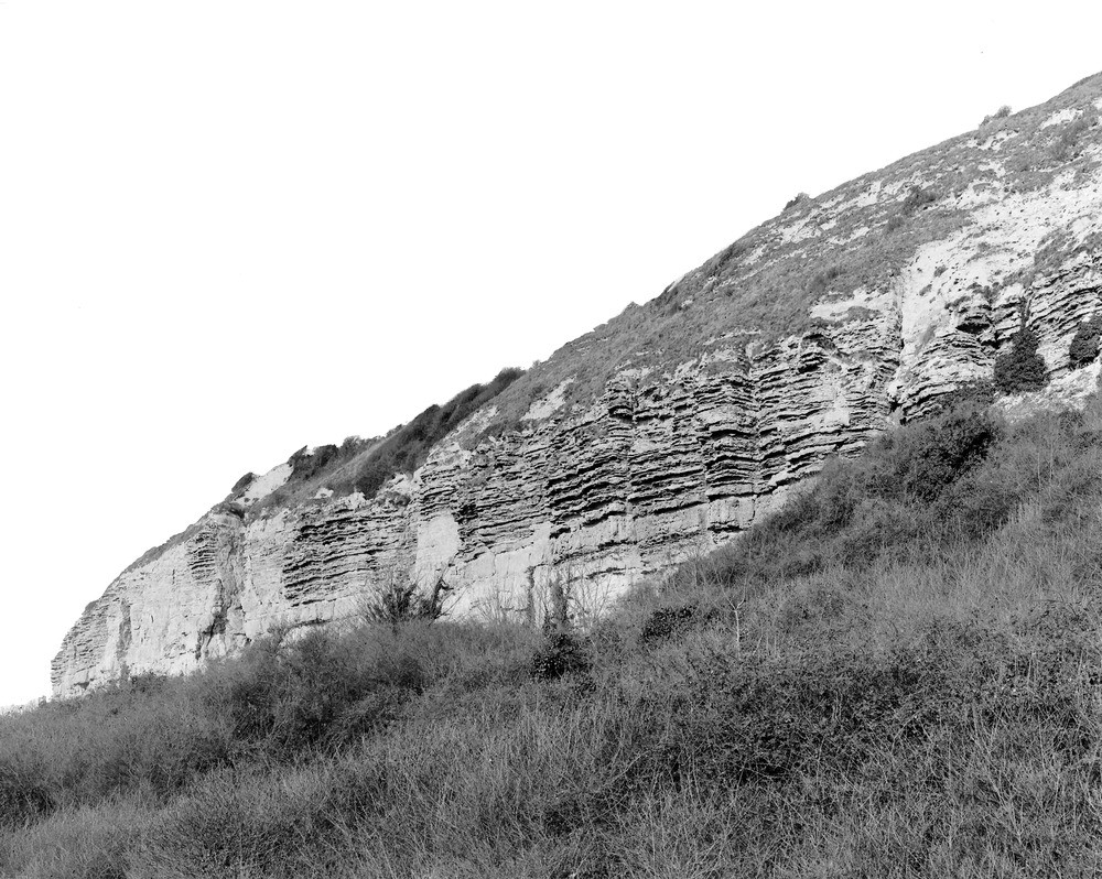
| Caption: | The Undercliff (general view) about 1 1/2 m. W. of St. Lawrence Station. Looking NW. |
| Description: | The Undercliff (general view) about 1 1/2 m. W. of St. Lawrence Station. Looking NW. Upper Greensand near St. Lawrence. Freestone Beds and overlying darker Chert Beds in the cliff; Lower Chalk in the slope above. The cliff is a slip-scarp of Recent age, due to the foundering of the masses of Gault, Upper Greensand, and Chalk which form the Undercliff in the foreground. Ref: 'A short account of the geology of the Isle of Wight', pp.56, 196. |
| Date taken: | Thu Mar 10 00:00:00 GMT 1921 |
| Photographer: | Rhodes, J. |
| Copyright statement: | Crown |
| X longitude/easting: | 453500 |
| Y latitude/northing: | 76500 |
| Coordinate reference system, ESPG code: | 27700 (OSGB 1936 / British National Grid) |
| Orientation: | Landscape |
| Size: | 283.07 KB; 1000 x 798 pixels; 85 x 68 mm (print at 300 DPI); 265 x 211 mm (screen at 96 DPI); |
| Average Rating: | Not yet rated |
| Categories: | Unsorted Images, Geoscience subjects/ Stratigraphical |
Loading...
Loading...
Reviews
There is currently no feedback