| P number: | P201701 |
|---|---|
| Old photograph number: | A01750 |
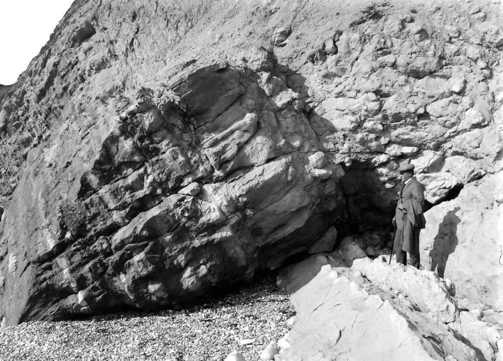
| Caption: | Cliff about 100 yd. E. of Red Cliff, Sandown Bay. Looking N. |
| Description: | Cliff about 100 yd. E. of Red Cliff, Sandown Bay. Looking N. Junction of Upper Greensand and Chalk, Culver Cliff. The highest part of the Upper Greensand appears on the left as a rather dark rock with irregular white bands. A lens of black chert is seen above (and to the right of) the lowest definite white band. The lighter rock with prismatic and sphenoidal jointing, in the middle of the view, is the Chloritic Marl, at the base of the Lower Chalk. The Lower Chalk proper or 'Chalk Marl', on the right, here contains hard concretions enclosing Plocoscyphia labrosa (T. Smith) and other sponges. Ref: 'A short account of the geology of the Isle of Wight', pp.59, 62, 63. |
| Date taken: | Tue Mar 01 00:00:00 GMT 1921 |
| Photographer: | Rhodes, J. |
| Copyright statement: | Crown |
| X longitude/easting: | 462500 |
| Y latitude/northing: | 85500 |
| Coordinate reference system, ESPG code: | 27700 (OSGB 1936 / British National Grid) |
| Orientation: | Landscape |
| Size: | 333.17 KB; 1001 x 718 pixels; 85 x 61 mm (print at 300 DPI); 265 x 190 mm (screen at 96 DPI); |
| Average Rating: | Not yet rated |
| Categories: | Unsorted Images, Geoscience subjects/ Stratigraphical |
Loading...
Loading...
Reviews
There is currently no feedback