| P number: | P211174 |
|---|---|
| Old photograph number: | A11531 |
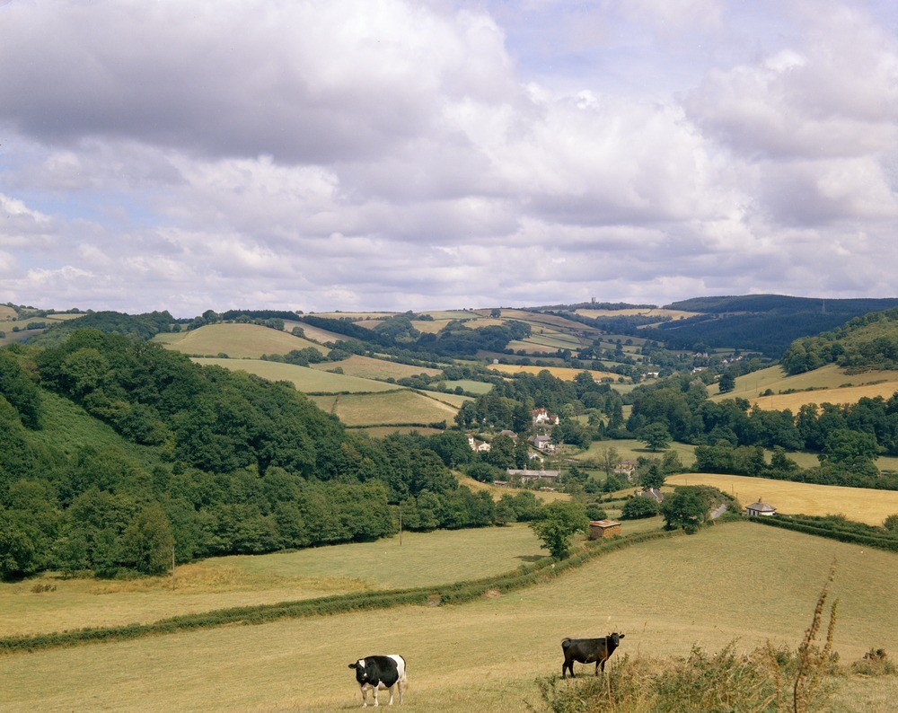
| Caption: | Lower Ashton. Looking NE. |
| Description: | Lower Ashton. Looking NE. Topography in Carboniferous rocks. The gentle slopes on either side of Lower Ashton village are formed by shales of the Upper Carboiferous Ashton Shale. These slopes pass into the marked ridges formed by the cherts of the Lower Carboniferous Teign Chert, well exhibited to the left of the photograph. A marked depression adjacent to the ridge on the left is formed by soft shales of the Lower Carboniferous Coombe Shale. |
| Date taken: | Thu Jan 01 00:00:00 GMT 1970 |
| Photographer: | Jeffery, C.J. |
| Copyright statement: | NERC |
| X longitude/easting: | 284500 |
| Y latitude/northing: | 84500 |
| Coordinate reference system, ESPG code: | 27700 (OSGB 1936 / British National Grid) |
| Orientation: | Landscape |
| Size: | 250.55 KB; 1000 x 794 pixels; 85 x 67 mm (print at 300 DPI); 265 x 210 mm (screen at 96 DPI); |
| Average Rating: | Not yet rated |
| Categories: | Unsorted Images, Geoscience subjects/ General views |
Loading...
Loading...
Reviews
There is currently no feedback