| P number: | P211353 |
|---|---|
| Old photograph number: | A11728 |
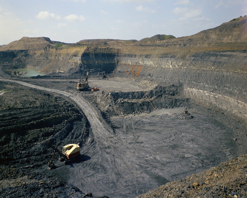
| Caption: | Moore's Pit No.1, 500 m. E. of site of Union Lodge, Woodville. Looking S. |
| Description: | Moore's Pit No.1, 500 m. E. of site of Union Lodge, Woodville. Looking S. Workings in strata at Overseal Marine Band horizon. This quarry is about 500 m. to the east of that shown in A11726 and shows the same beds, in an unweathered state. The Overseal Marine Band is the dark-coloured clay band in the middle part of the face. Below it are light coloured seatearths. Above it is a light yellowish sandstone, overlain in turn by seatearth and carbonaceous shale. |
| Date taken: | Fri Jan 01 00:00:00 GMT 1971 |
| Photographer: | Evans, H.J. |
| Copyright statement: | NERC |
| X longitude/easting: | 430500 |
| Y latitude/northing: | 317500 |
| Coordinate reference system, ESPG code: | 27700 (OSGB 1936 / British National Grid) |
| Orientation: | Landscape |
| Size: | 342.96 KB; 1000 x 805 pixels; 85 x 68 mm (print at 300 DPI); 265 x 213 mm (screen at 96 DPI); |
| Average Rating: | Not yet rated |
| Categories: | Unsorted Images, Geoscience subjects/ Economic geology/ Coal, Geoscience subjects/ Economic geology/ Quarries, opencast |
Loading...
Loading...
Reviews
There is currently no feedback