| P number: | P000055 |
|---|---|
| Old photograph number: | C02881 |
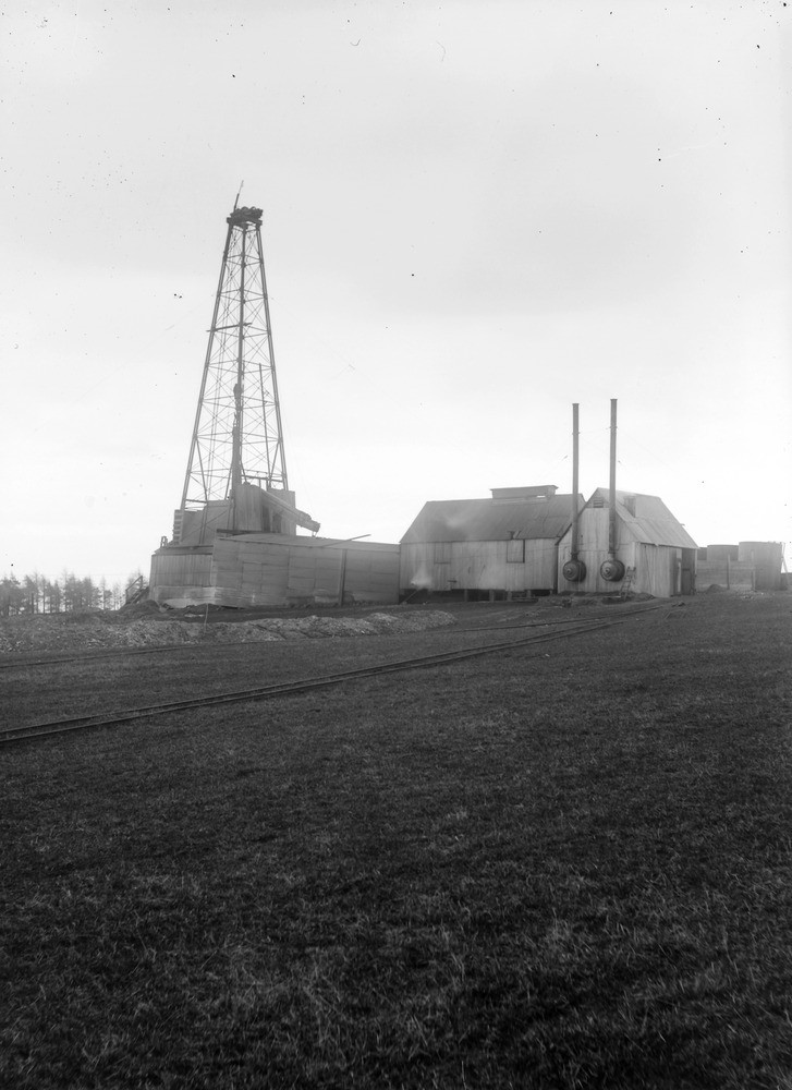
| Caption: | D'Arcy, 4.0 km. south-east of Dalkeith and 1.6 km. south-south-west of the mining village of Chesterhill. (Site of borehole, 1919-1922.) Midlothian. General view of oil well drilling rig. |
| Description: | D'Arcy, 4.0 km. south-east of Dalkeith and 1.6 km. south-south-west of the mining village of Chesterhill. (Site of borehole, 1919-1922.) Midlothian. General view of oil well drilling rig. Standard Oil Well Rig' used for the hole drilled for the Government at D'Arcy by Messrs. S. Pearson and Son Ltd. The boring was commenced in October 1919 but was delayed at first by the difficulties in obtaining suitable water supplies. One of a series of eleven oil wells drilled in Great Britain for the Mineral Oil Production Department of the Ministry of Munitions. The method of drilling was the American cable system with percussive tools. |
| Date taken: | Sat Jan 01 00:00:00 GMT 1921 |
| Photographer: | Tait, D. |
| Copyright statement: | Crown |
| Acknowledgment: | This image was digitized with grant-in-aid from SCRAN the Scottish Cultural Resources Access Network |
| X longitude/easting: | 336500 |
| Y latitude/northing: | 634500 |
| Coordinate reference system, ESPG code: | 27700 (OSGB 1936 / British National Grid) |
| Orientation: | Portrait |
| Size: | 142.79 KB; 727 x 1000 pixels; 62 x 85 mm (print at 300 DPI); 192 x 265 mm (screen at 96 DPI); |
| Average Rating: | Not yet rated |
| Categories: | Best of BGS Images/ Images from the archives |
Loading...
Loading...
Reviews
There is currently no feedback