| P number: | P000875 |
|---|---|
| Old photograph number: | D02515 |
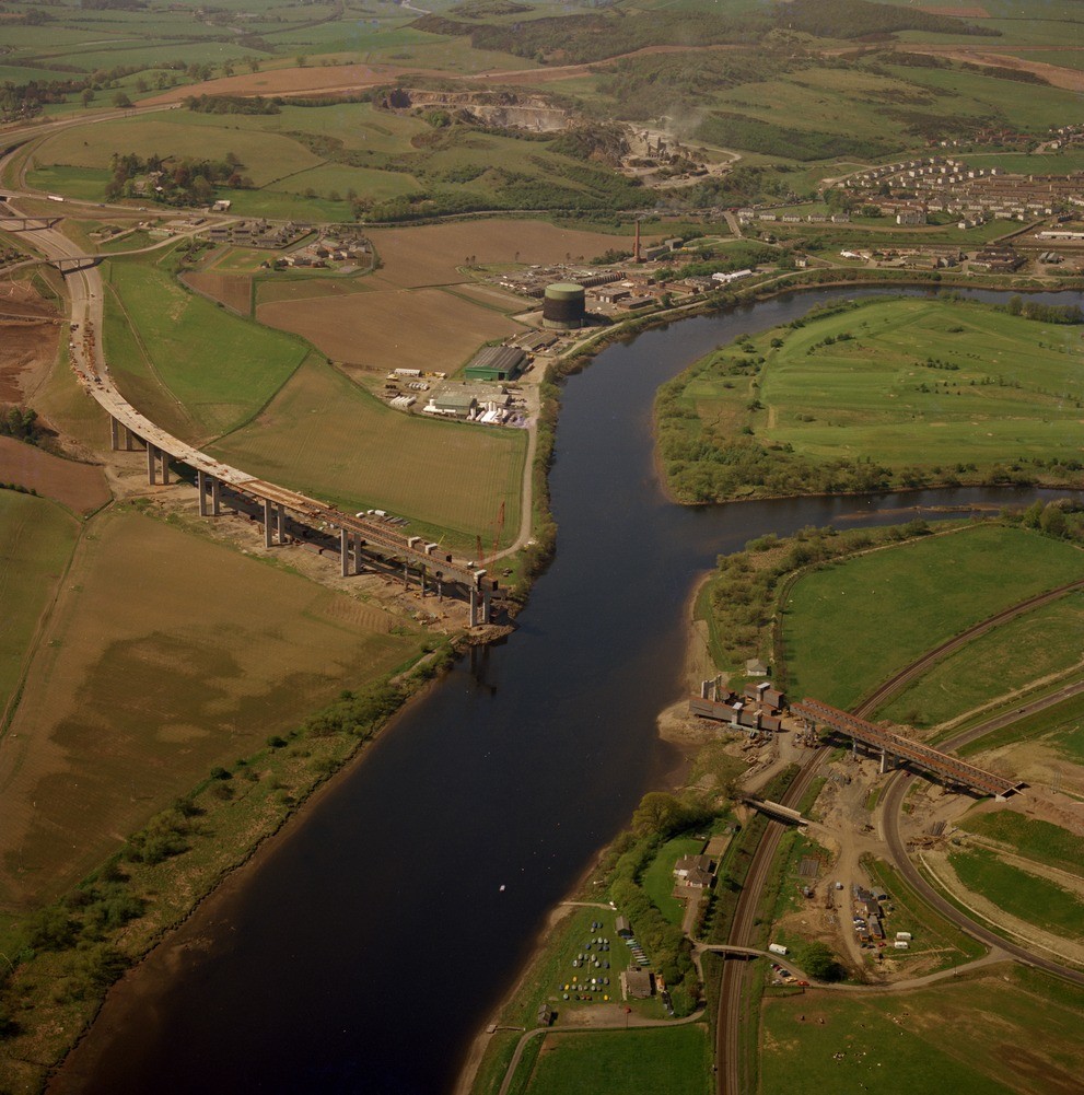
| Caption: | Oblique aerial view taken from above River Tay below Perth, looking west towards the new M85 road bridge works below Friarton Island which can be seen on the right. |
| Description: | Oblique aerial view taken from above River Tay below Perth, looking west towards the new M85 road bridge works below Friarton Island which can be seen on the right. The roadworks are on fill of a buried channel of the River Tay, a late-glacial erosional feature. This channel descends to at least 29 m. below Ordnance Datum. Lower Devonian lavas in Friarton Quarries in background are being extracted for hardrock aggregates (roadstones). The buried channel descending to at least 29 m. below O.D. is clear evidence of the late-glacial fall in sea level, almost certainly during the period called the Loch Lomond Stadial. |
| Date taken: | Sat Jan 01 00:00:00 GMT 1977 |
| Photographer: | Christie, A. |
| Copyright statement: | NERC |
| Acknowledgment: | This image was digitized with grant-in-aid from SCRAN the Scottish Cultural Resources Access Network |
| X longitude/easting: | 313000 |
| Y latitude/northing: | 721700 |
| Coordinate reference system, ESPG code: | 27700 (OSGB 1936 / British National Grid) |
| Orientation: | Portrait |
| Size: | 269.44 KB; 991 x 1001 pixels; 84 x 85 mm (print at 300 DPI); 262 x 265 mm (screen at 96 DPI); |
| Average Rating: | Not yet rated |
| Categories: | Best of BGS Images/ Industrial geology |
Loading...
Loading...
Reviews
There is currently no feedback