| P number: | P001426 |
|---|---|
| Old photograph number: | Z00007 |
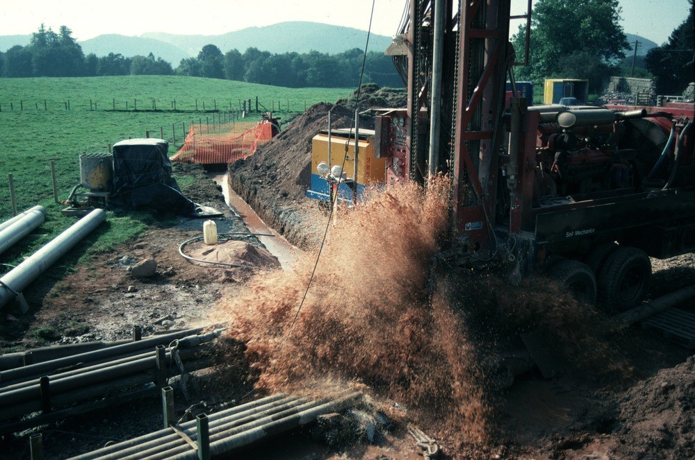
| Caption: | Hardthorn Road site, Dumfries, Dumfries and Galloway Region. Water strike during drilling for groundwater at Hardthorn Road. |
| Description: | The rotary drilling rig encountered only dry Permian breccia to 56 m. depth. At this level, a water-bearing fissure suddenly produced a surge of water at the surface. Other fissures were encountered at intervals to 130 m. depth. The final yield of water from the borehole was over 35 litres per second. The borehole is to be used by West of Scotland Water as part of the Dumfries public supply system. The Silurian hills can be seen in the background. These encircle the Permian aquifer in the floor of the basin. |
| Date taken: | Thu Jan 01 00:00:00 GMT 1998 |
| Photographer: | Ball, D.F. |
| Copyright statement: | NERC |
| X longitude/easting: | 293650 |
| Y latitude/northing: | 578120 |
| Coordinate reference system, ESPG code: | 27700 (OSGB 1936 / British National Grid) |
| Orientation: | Landscape |
| Size: | 239.68 KB; 1000 x 663 pixels; 85 x 56 mm (print at 300 DPI); 265 x 175 mm (screen at 96 DPI); |
| Average Rating: | Not yet rated |
| Categories: | Best of BGS Images/ Industrial geology |
Loading...
Loading...
Reviews
There is currently no feedback