| P number: | P000801 |
|---|---|
| Old photograph number: | D02351 |
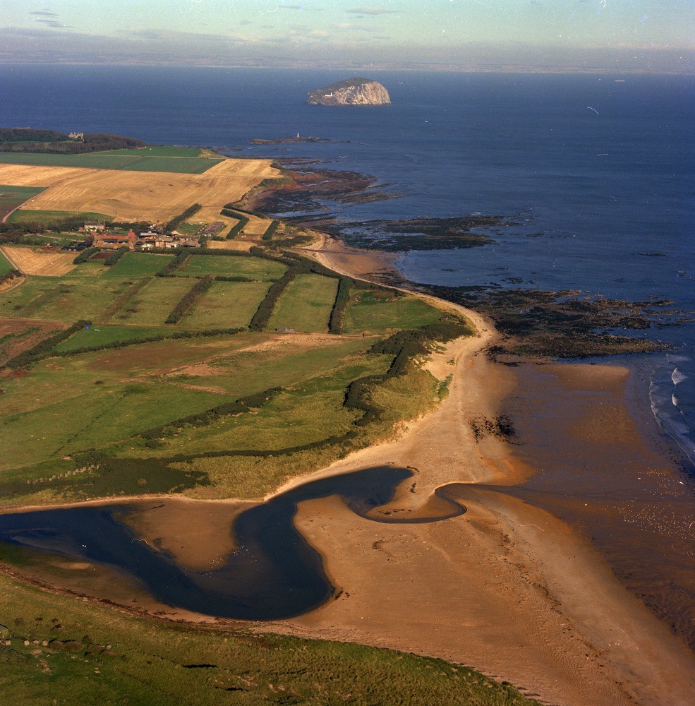
| Caption: | Oblique aerial view of Peffer Burn, 2.5 km. north-east of Whitekirk. East Lothian. |
| Description: | Estuarine deposits cover the bottom of the valley of the Peffer Burn in an area trending north-east - south-west 7 km. long by 1.5 to 3 km. wide. At the estuary, clays and silts give way to sands and gravels, then bordering the sea and extending up and down the coast are blown sands. Bass Rock a phonolitic trachyte plug in the distance. Looking north-west. The photograph shows estuary sedimentation at the mouth of the Peffer Burn and the late-glacial sand and gravel raised beach at Seacliff just beyond Scoughall. |
| Date taken: | Sat Jan 01 00:00:00 GMT 1977 |
| Photographer: | Christie, A. |
| Copyright statement: | NERC |
| Acknowledgment: | This image was digitized with grant-in-aid from SCRAN the Scottish Cultural Resources Access Network |
| X longitude/easting: | 362000 |
| Y latitude/northing: | 682500 |
| Coordinate reference system, ESPG code: | 27700 (OSGB 1936 / British National Grid) |
| Orientation: | Portrait |
| Size: | 287.30 KB; 985 x 1000 pixels; 83 x 85 mm (print at 300 DPI); 261 x 265 mm (screen at 96 DPI); |
| Average Rating: | Not yet rated |
| Categories: | Best of BGS Images/ Geological structures |
Loading...
Loading...
Reviews
There is currently no feedback