| P number: | P000795 |
|---|---|
| Old photograph number: | D02344 |
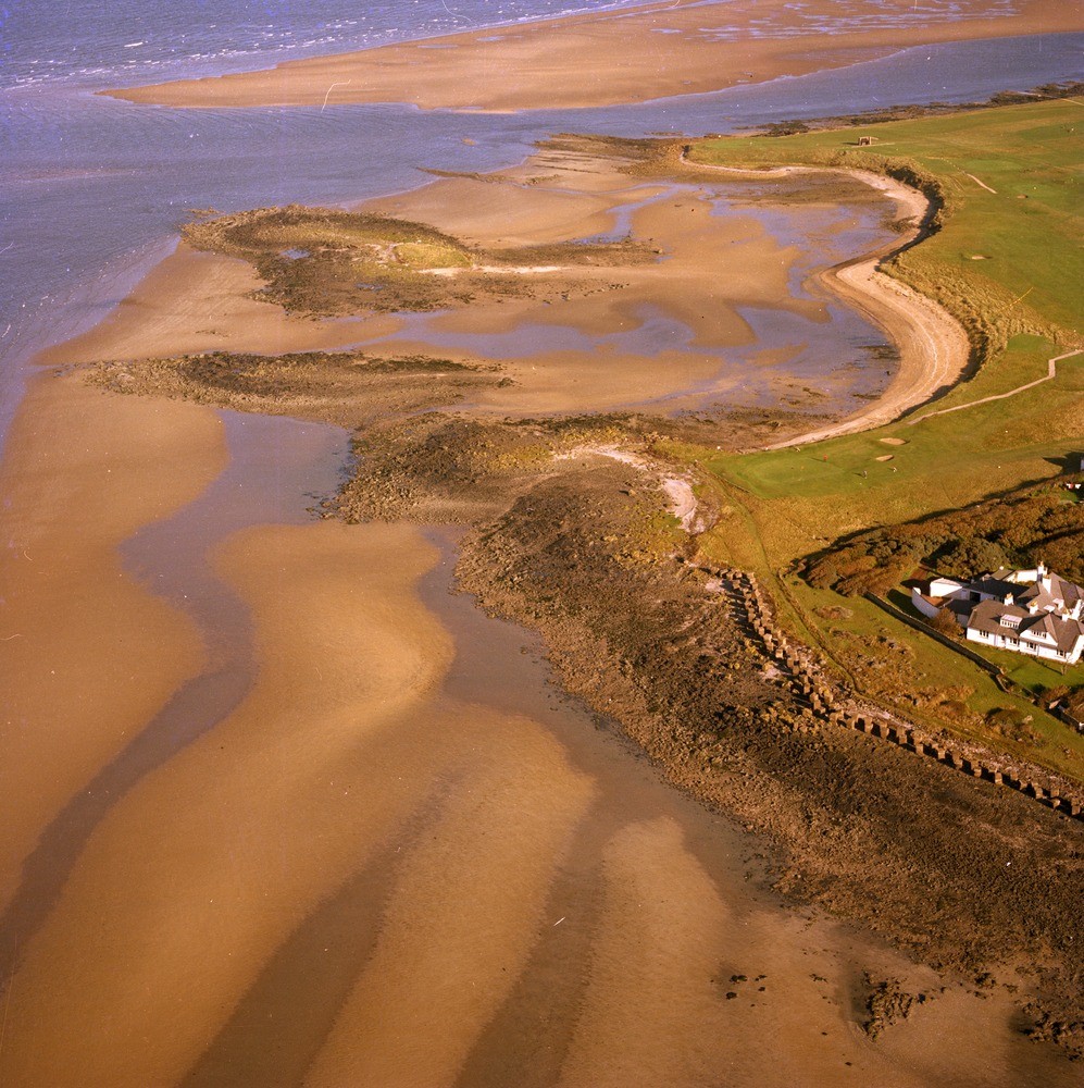
| Caption: | Oblique aerial view of Craigielaw Point, Aberlady. East Lothian. Looking north-west. Bedded sediments. Lower Limestone Group. |
| Description: | Oblique aerial view of Craigielaw Point, Aberlady. East Lothian. Looking north-west. Bedded sediments. Lower Limestone Group. The Lower Limestone Group is the uppermost division of the Lower Carboniferous in the district. The strata has a regional dip to the west or north-west of up to 5 degrees, though between Craigielaw Point and Aberlady Point gentle minor folds are superimposed on the larger structure. Note the concrete anti-landing defences from World War 2. |
| Date taken: | Sat Jan 01 00:00:00 GMT 1977 |
| Photographer: | Christie, A. |
| Copyright statement: | NERC |
| Acknowledgment: | This image was digitized with grant-in-aid from SCRAN the Scottish Cultural Resources Access Network |
| X longitude/easting: | 344500 |
| Y latitude/northing: | 680000 |
| Coordinate reference system, ESPG code: | 27700 (OSGB 1936 / British National Grid) |
| Orientation: | Portrait |
| Size: | 337.20 KB; 997 x 1000 pixels; 84 x 85 mm (print at 300 DPI); 264 x 265 mm (screen at 96 DPI); |
| Average Rating: | Not yet rated |
| Categories: | Best of BGS Images/ Geological structures |
Loading...
Loading...
Reviews
There is currently no feedback