| P number: | P001993 |
|---|---|
| Old photograph number: | C00393 |
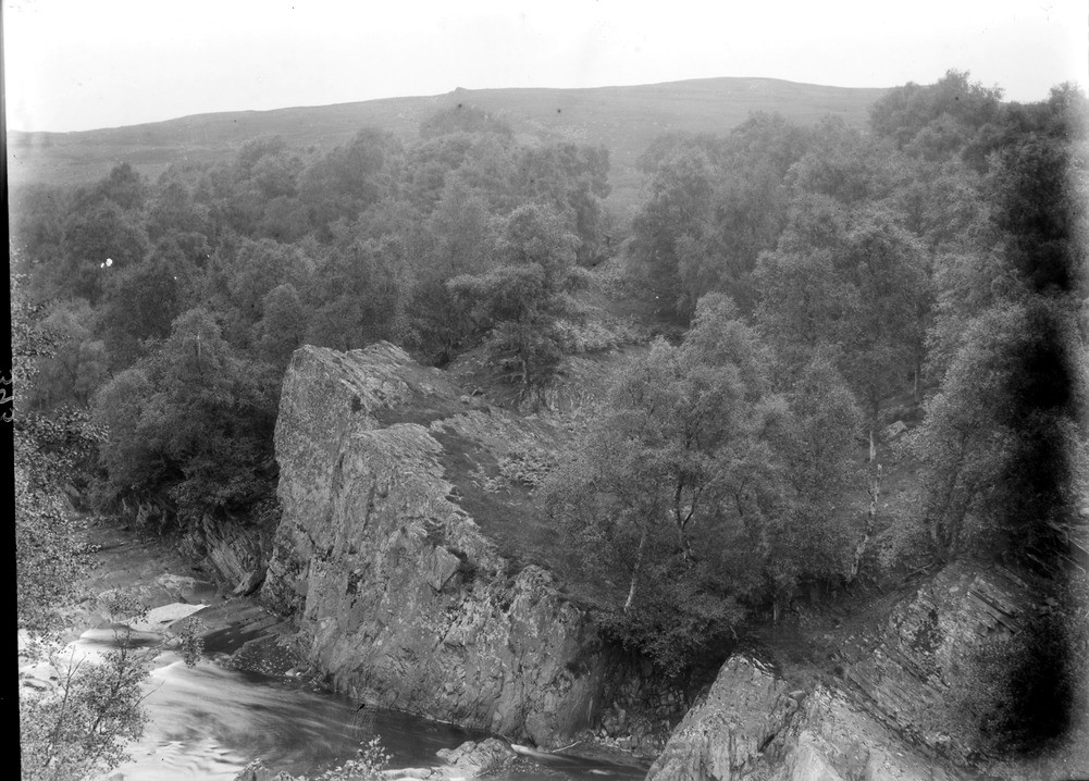
| Caption: | River Garry, 0.8 km. west of Clunes, 2.6 km. west-north-west of Struan Station, Perthshire. Sill of porphyritic microgranodiorite (formerly called quartz-porphyry) in the Dalradian Grampian Group psammitic schists. |
| Description: | River Garry, 0.8 km. west of Clunes, 2.6 km. west-north-west of Struan Station, Perthshire. Sill of porphyritic microgranodiorite (formerly called quartz-porphyry) in the Dalradian Grampian Group psammitic schists. The sill can be seen extending over the hillside to the prominent feature on the skyline. The sill is more resistant to erosion than the surrounding older psammitic schists and so forms a distinctive positive feature. |
| Date taken: | Wed Jan 01 00:00:00 GMT 1902 |
| Photographer: | Lunn, R. |
| Copyright statement: | Crown |
| Acknowledgment: | This image was digitized with grant-in-aid from SCRAN the Scottish Cultural Resources Access Network |
| X longitude/easting: | 277400 |
| Y latitude/northing: | 767700 |
| Coordinate reference system, ESPG code: | 27700 (OSGB 1936 / British National Grid) |
| Orientation: | Landscape |
| Size: | 228.76 KB; 1001 x 718 pixels; 85 x 61 mm (print at 300 DPI); 265 x 190 mm (screen at 96 DPI); |
| Average Rating: | Not yet rated |
| Categories: | Unsorted Images, Geoscience subjects/ Igneous features/ Sills |
Loading...
Loading...
Reviews
There is currently no feedback