| P number: | P212715 |
|---|---|
| Old photograph number: | A13738 |
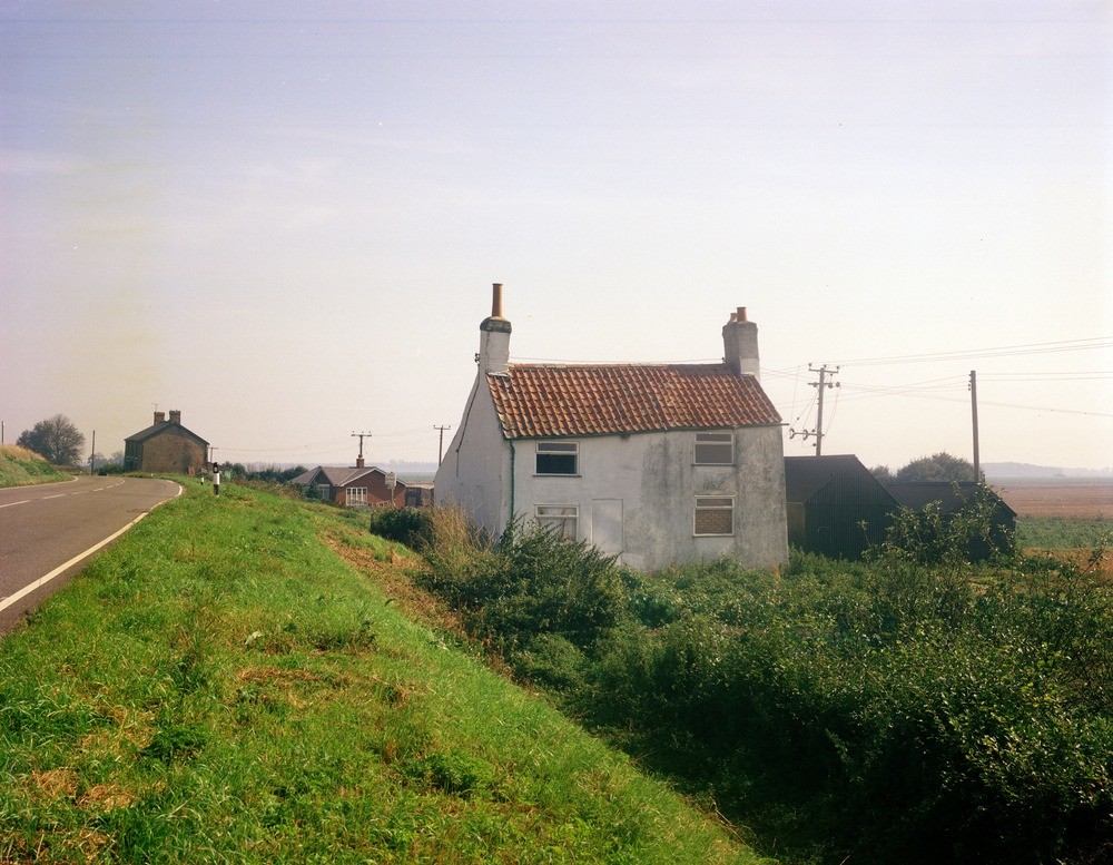
| Caption: | Burnt Fen, Littleport. |
| Description: | Burnt Fen, Littleport. Peat shrinkage. Uneven subsidence caused by peat shrinkage has distorted (foreground) and tilted (background) some of the older houses in the district. Many modern buildings (middle ground) are build on raft foundations to avoid this problem. |
| Date taken: | Mon Jan 01 00:00:00 GMT 1979 |
| Photographer: | Collins, R.E. |
| Copyright statement: | NERC |
| X longitude/easting: | 558500 |
| Y latitude/northing: | 288700 |
| Coordinate reference system, ESPG code: | 27700 (OSGB 1936 / British National Grid) |
| Orientation: | Landscape |
| Size: | 227.87 KB; 1000 x 777 pixels; 85 x 66 mm (print at 300 DPI); 265 x 206 mm (screen at 96 DPI); |
| Average Rating: | Not yet rated |
| Categories: | Unsorted Images, Geoscience subjects/ Economic geology/ Peat |
Loading...
Loading...
Reviews
There is currently no feedback