| P number: | P000235 |
|---|---|
| Old photograph number: | B00232 |
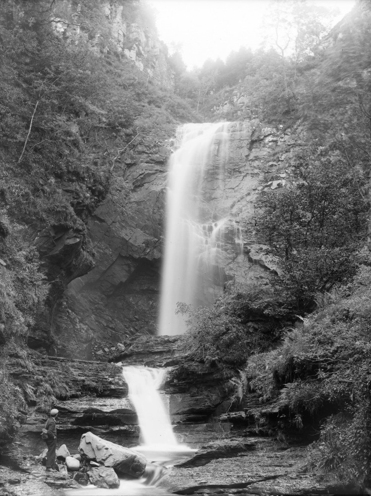
| Caption: | Glenashdale Falls, 2.146 km. west of Whiting Bay, south-east coast of Arran. Buteshire. A Tertiary dolerite sill intruded into Triassic sandstones, dipping upstream and giving rise to a waterfall. A close-up view. |
| Description: | Glenashdale Falls, 2.146 km. west of Whiting Bay, south-east coast of Arran. Buteshire. A Tertiary dolerite sill intruded into Triassic sandstones, dipping upstream and giving rise to a waterfall. A close-up view. The waterfall is formed by the water falling over the harder, resistant quartz-dolerite and eroding away the softer Triassic sedimentary rocks beneath. In the cycle of river valley development the waterfall will eventually retreat up the valley, lose height and degrade to rapids and eventually smooth out entirely. |
| Date taken: | Fri Jan 01 00:00:00 GMT 1897 |
| Photographer: | Lunn, R. |
| Copyright statement: | Crown |
| Acknowledgment: | This image was digitized with grant-in-aid from SCRAN the Scottish Cultural Resources Access Network |
| X longitude/easting: | 202400 |
| Y latitude/northing: | 624800 |
| Coordinate reference system, ESPG code: | 27700 (OSGB 1936 / British National Grid) |
| Orientation: | Portrait |
| Size: | 255.75 KB; 749 x 1000 pixels; 63 x 85 mm (print at 300 DPI); 198 x 265 mm (screen at 96 DPI); |
| Average Rating: | Not yet rated |
| Categories: | Unsorted Images, Geoscience subjects/ Landforms, river/ Waterfalls and pot-holes |
Loading...
Loading...
Reviews
There is currently no feedback