| P number: | P000760 |
|---|---|
| Old photograph number: | D02174 |
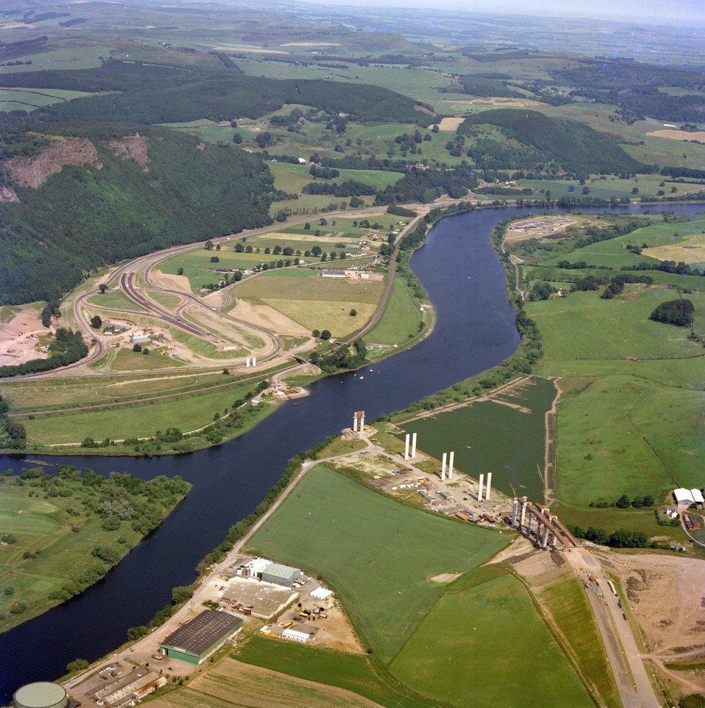
| Caption: | Oblique aerial view taken from above the M9 Craigend Interchange of the western Sidlaw Hills and the River Tay, one mile south-east of Perth. The photograph takes in the construction of the M85 bridge over the River Tay. |
| Description: | Oblique aerial view taken from above the M9 Craigend Interchange of the western Sidlaw Hills and the River Tay, one mile south-east of Perth. The photograph takes in the construction of the M85 bridge over the River Tay. The high ground beyond the River Tay is composed of lavas and volcanic conglomerates of Lower Devonian age. The lower ground beside the Tay is situated on the superficial deposits which fill the buried channel of the Tay. |
| Date taken: | Thu Jan 01 00:00:00 GMT 1976 |
| Photographer: | Christie, A. |
| Copyright statement: | NERC |
| Acknowledgment: | This image was digitized with grant-in-aid from SCRAN the Scottish Cultural Resources Access Network |
| X longitude/easting: | 312500 |
| Y latitude/northing: | 720500 |
| Coordinate reference system, ESPG code: | 27700 (OSGB 1936 / British National Grid) |
| Orientation: | Portrait |
| Size: | 356.98 KB; 995 x 1000 pixels; 84 x 85 mm (print at 300 DPI); 263 x 265 mm (screen at 96 DPI); |
| Average Rating: | Not yet rated |
| Categories: | Best of BGS Images/ Industrial geology |
Loading...
Loading...
Reviews
There is currently no feedback