| P number: | P000683 |
|---|---|
| Old photograph number: | D01830 |
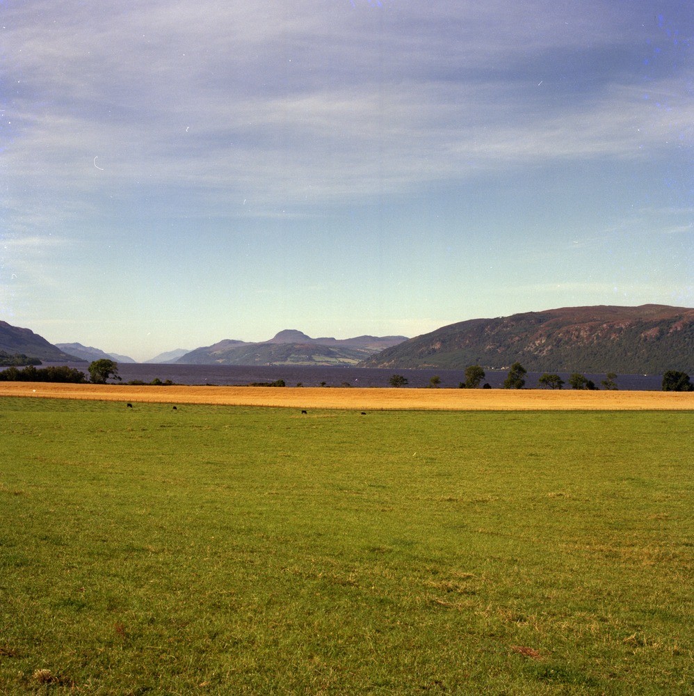
| Caption: | Looking south-west from Dores along Loch Ness, Inverness-shire. The loch which runs along the line of the Great Glen Fault has been greatly deepened by glacial action. |
| Description: | Looking south-west from Dores along Loch Ness, Inverness-shire. The loch which runs along the line of the Great Glen Fault has been greatly deepened by glacial action. Raised beach terrace in foreground. Steep hillside on right is cut in Moine granulite, smooth green hills in middle distance are Old Red Sandstone sandstone capped by Old Red Sandstone conglomerate hills forming Meall Fuar-mhonaidh and Creag Dhearg, both of Devonian age. |
| Date taken: | Thu Jan 01 00:00:00 GMT 1976 |
| Photographer: | Christie, A. |
| Copyright statement: | NERC |
| Acknowledgment: | This image was digitized with grant-in-aid from SCRAN the Scottish Cultural Resources Access Network |
| X longitude/easting: | 259700 |
| Y latitude/northing: | 835000 |
| Coordinate reference system, ESPG code: | 27700 (OSGB 1936 / British National Grid) |
| Orientation: | Portrait |
| Size: | 302.99 KB; 998 x 1000 pixels; 84 x 85 mm (print at 300 DPI); 264 x 265 mm (screen at 96 DPI); |
| Average Rating: | Not yet rated |
| Categories: | Unsorted Images, Geoscience subjects/ Named locality |
Loading...
Loading...
Reviews
There is currently no feedback