| P number: | P017099 |
|---|---|
| Old photograph number: | MNS09121 |
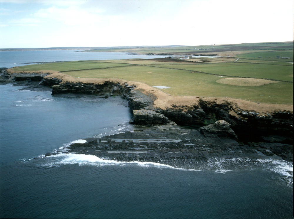
| Caption: | Oblique aerial view of The Haven, view to south-east; including Markle Bay and Dunnet Bay, Caithness. |
| Description: | Oblique aerial view of The Haven, view to south-east; including Markle Bay and Dunnet Bay, Caithness. The bedding in this area dips gently (between 9 and 12 degrees) to north-west and west. The rocks, in the Mey Subgroup of the Upper Caithness Flagstone Group in the Middle Old Red Sandstone, are made up of successive beds of carbon-rich lacustrine shale, siltstone and finely-bedded sandstone with ripple marks present. These beds alternate with smoothly-bedded calcareous flags bearing fish remains ('fish-beds'). The flagstones have a well-defined slab-like appearance, caused by vertical and horizons joints and fractures; these are exploited by the erosive action of the sea which has created a wave-cut platform and the detachment of parts of the cliff in this picture. The cliffs are capped by a layer of boulder clay. Beyond the Haven, Murkle Bay and Dunnet Bay can be seen: the small mound is one of a number of Neolithic structures common to this area. |
| Date taken: | Tue Jan 01 00:00:00 GMT 1991 |
| Photographer: | Bain, T.S. |
| Copyright statement: | NERC |
| Acknowledgment: | This image was digitized with grant-in-aid from SCRAN the Scottish Cultural Resources Access Network |
| X longitude/easting: | 316200 |
| Y latitude/northing: | 970000 |
| Coordinate reference system, ESPG code: | 27700 (OSGB 1936 / British National Grid) |
| Orientation: | Landscape |
| Size: | 177.31 KB; 1000 x 746 pixels; 85 x 63 mm (print at 300 DPI); 265 x 197 mm (screen at 96 DPI); |
| Average Rating: | Not yet rated |
| Categories: | Best of BGS Images/ Landscapes |
Loading...
Loading...
Reviews
There is currently no feedback