| P number: | P008519 |
|---|---|
| Old photograph number: | D04270 |
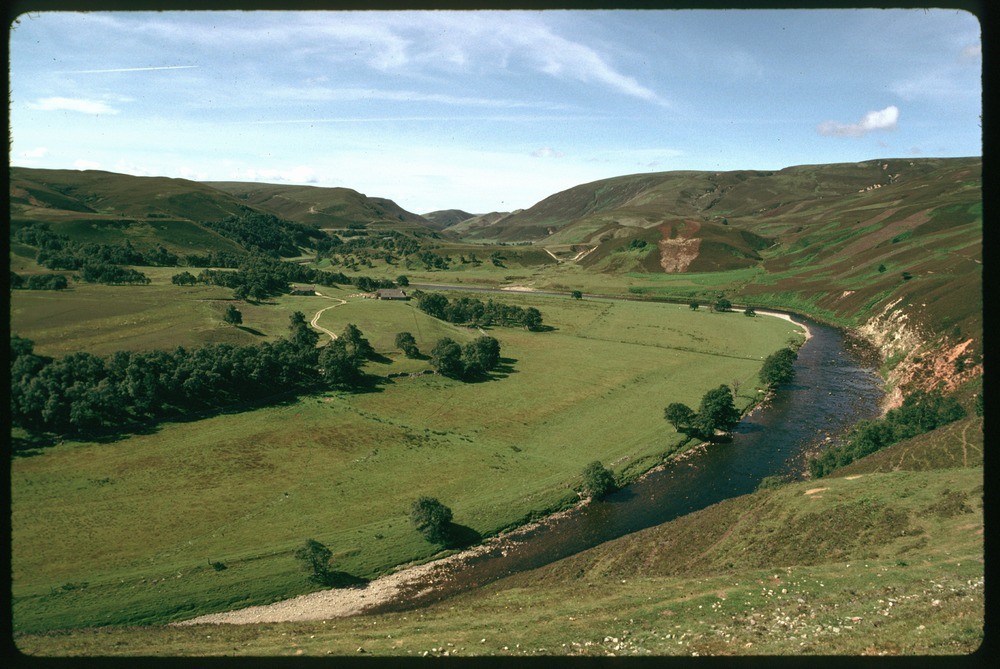
| Caption: | Quilichan, taken from 10 km. NE of Moy. |
| Description: | Quilichan, taken from 10 km. NE of Moy. The valley of the River Findhorn, looking south-west from Daless. In the foreground (left) flood plain alluvium and low-lying fluvial and fluvioglacial outwash terraces. In the middle ground (right) irregular mounds of englacially and sub-glacially deposited sand and gravel. In the background flat-topped, stepped outwash fans. Note viewpoint on boundary between sheets 84W and 84E - view of sheet 84W. |
| Date taken: | Sat Jul 01 00:00:00 BST 1989 |
| Photographer: | McTaggart, F.I. |
| Copyright statement: | NERC |
| Acknowledgment: | This image was digitized with grant-in-aid from JIDI the JISC Image Digitization Initiative |
| X longitude/easting: | 285700 |
| Y latitude/northing: | 838300 |
| Coordinate reference system, ESPG code: | 27700 (OSGB 1936 / British National Grid) |
| Orientation: | Landscape |
| Size: | 215.52 KB; 1000 x 669 pixels; 85 x 57 mm (print at 300 DPI); 265 x 177 mm (screen at 96 DPI); |
| Average Rating: | Not yet rated |
| Categories: | Best of BGS Images/ Landscapes |
Loading...
Loading...
Reviews
There is currently no feedback