| P number: | P008136 |
|---|---|
| Old photograph number: | A12933 |
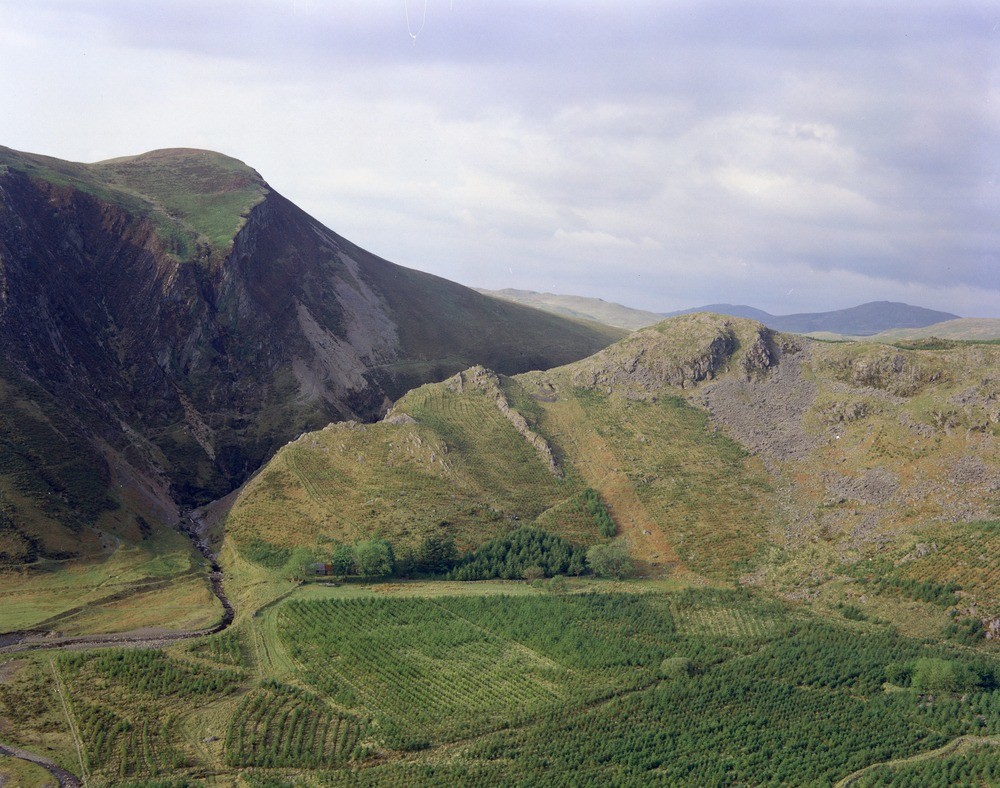
| Caption: | Track, about 500 m. SW of Craigypistyll. |
| Description: | Track, about 500 m. SW of Craigypistyll. The Camdwr Fault at Craigypistyll. The Camdwr Fault passes behind the ridge in the centre and right middle distance and in front of the cliffs in the left of the photograph. The fault has a northerly downthrow and there is lead/zinc mineralisation in the gorge and elsewhere along its length. The high ground at the left shows a sequence of Lower, Middle and Upper Llandovery Series sediments. Lower Llandovery Series mudstones occupy the smooth slope to the right of the scarp, and Middle and Upper Llandovery Series mudstones and sandstones form the cliffs at the top of the scarp. In the cliff on the extreme left these beds are folded into a sharp syncline. The crags at the right-hand end of the ridge in the middle distance are formed by massive sandstones of the Drosgol Formation (Ordovician). These are overlain by mainly unbedded mudstones of the Brynglas Formation and at the extreme left-hand end of the ridge, by grey bedded mudstones of Upper Llandovery Series age. The low ground in front of the ridge is occupied by alluvium, river terrace and peat. |
| Date taken: | Sat Jan 01 00:00:00 GMT 1977 |
| Photographer: | Jeffery, C.J. |
| Copyright statement: | NERC |
| Acknowledgment: | This image was digitized with grant-in-aid from JIDI the JISC Image Digitization Initiative |
| X longitude/easting: | 270880 |
| Y latitude/northing: | 285000 |
| Coordinate reference system, ESPG code: | 27700 (OSGB 1936 / British National Grid) |
| Orientation: | Landscape |
| Size: | 274.07 KB; 1000 x 788 pixels; 85 x 67 mm (print at 300 DPI); 265 x 208 mm (screen at 96 DPI); |
| Average Rating: | Not yet rated |
| Categories: | Best of BGS Images/ Geological structures, Geoscience subjects/ Structural features/ Fault breccia |
Loading...
Loading...
Reviews
There is currently no feedback