| P number: | P008022 |
|---|---|
| Old photograph number: | L01010 |
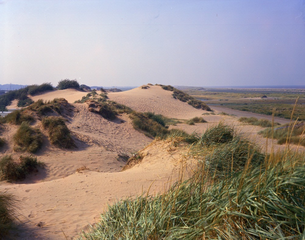
| Caption: | E. of Prestatyn. Looking S. |
| Description: | E. of Prestatyn. Looking S. Sand-dunes and estuarine alluvium. Between Prestatyn and Gronant an inland line of sand-dunes marks a former shore line. Dunes which fringe the present beach can be seen in the right distance. Between the two is an expanse of estuarine alluvium, with lower ridges of blown sand and shingle, now protected from flooding by artificial barriers and sluices. |
| Date taken: | Sun Sep 01 00:00:00 BST 1968 |
| Photographer: | Dobson, C. |
| Copyright statement: | NERC |
| Acknowledgment: | This image was digitized with grant-in-aid from JIDI the JISC Image Digitization Initiative |
| X longitude/easting: | 308000 |
| Y latitude/northing: | 384000 |
| Coordinate reference system, ESPG code: | 27700 (OSGB 1936 / British National Grid) |
| Orientation: | Landscape |
| Size: | 244.01 KB; 1001 x 789 pixels; 85 x 67 mm (print at 300 DPI); 265 x 209 mm (screen at 96 DPI); |
| Average Rating: | Not yet rated |
| Categories: | Unsorted Images, Geoscience subjects/ Landforms, marine/ Coastal deposition, sand-bars, shingle-ridges, storm-beaches |
Loading...
Loading...
Reviews
There is currently no feedback