| P number: | P208774 |
|---|---|
| Old photograph number: | A08852 |
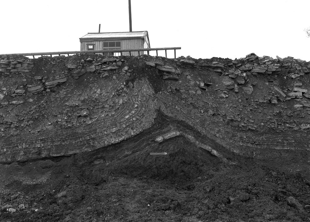
| Caption: | Fold at Stanton Wick Reservoir excavation near Clutton, Somerset, Somerset. |
| Description: | Stanton Wick Reservoir excavation near Clutton, Somerset. Looking south. Detail of bulge. The Triassic White Lias (now known as the Langport Member) is seen resting upon Upper Rhaetic clay forming the core of the fold, the prominent limestone band near the top of the Rhaetic clay is the Cotham Marble. The shattered and jointed nature of the upper part of the White Lias shows the effect of freezing. Contorted and involuted brown stony loam is seen cutting the Lias limestone at the top of the fold. The Cotham Marble is a hard splintery calcite-mudstone with an irregular mammilated top and a smooth flat base. It is noted for it's tree-like markings and the cloud-like forms above, hence the popular name 'Landscape Marble'. The 'landscape' is an association of algal growths occurring in convex masses. |
| Date taken: | Tue Jul 01 00:00:00 BST 1952 |
| Photographer: | Rhodes, J. |
| Copyright statement: | Crown |
| X longitude/easting: | 361500 |
| Y latitude/northing: | 160500 |
| Coordinate reference system, ESPG code: | 27700 (OSGB 1936 / British National Grid) |
| Orientation: | Landscape |
| Size: | 263.01 KB; 1000 x 715 pixels; 85 x 61 mm (print at 300 DPI); 265 x 189 mm (screen at 96 DPI); |
| Average Rating: | Not yet rated |
| Categories: | Best of BGS Images/ Images from the archives, Geoscience subjects/ Landforms, weathering/ Frost action and debris |
Loading...
Loading...
Reviews
There is currently no feedback