| P number: | P208699 |
|---|---|
| Old photograph number: | A08777 |
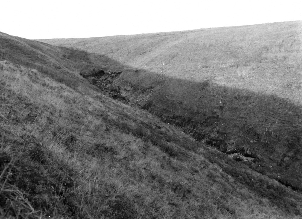
| Caption: | 1200 yd. N. 30 degrees W. of Duresdown Farm, (same viewpoint as No A8778). Looking NNE. |
| Description: | 1200 yd. N. 30 degrees W. of Duresdown Farm, (same viewpoint as No A8778). Looking NNE. North Exmoor floods, 1952. Tangs Bottom, showing start of erosion. Note two small slips of soil and this head exposing Ilfracombe Shale. |
| Date taken: | Sun Oct 05 00:00:00 BST 1952 |
| Photographer: | Rhodes, J. |
| Copyright statement: | Crown |
| X longitude/easting: | 275500 |
| Y latitude/northing: | 141500 |
| Coordinate reference system, ESPG code: | 27700 (OSGB 1936 / British National Grid) |
| Orientation: | Landscape |
| Size: | 217.88 KB; 1000 x 727 pixels; 85 x 62 mm (print at 300 DPI); 265 x 192 mm (screen at 96 DPI); |
| Average Rating: | Not yet rated |
| Categories: | Unsorted Images, Geoscience subjects/ Landforms, river/ Floods |
Loading...
Loading...
Reviews
There is currently no feedback