| P number: | P208698 |
|---|---|
| Old photograph number: | A08776 |
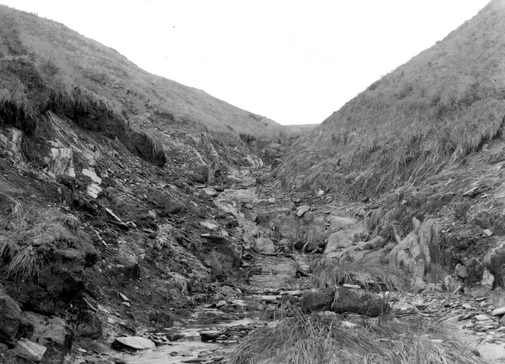
| Caption: | 1150 yd. NNW of Duresdown Farm, (NW of Simonsbath). Looking N. - NNE. |
| Description: | 1150 yd. NNW of Duresdown Farm, (NW of Simonsbath). Looking N. - NNE. North Exmoor floods, 1952. Tangs Bottom. Intense erosion has largely cleaned out the drift - peat resting on head - which formerly occupied the valley bottom thus exposing solid Ilfracombe Beds shale in the sides and bottom. Note the flood marks. |
| Date taken: | Sun Oct 05 00:00:00 BST 1952 |
| Photographer: | Rhodes, J. |
| Copyright statement: | Crown |
| X longitude/easting: | 275500 |
| Y latitude/northing: | 141500 |
| Coordinate reference system, ESPG code: | 27700 (OSGB 1936 / British National Grid) |
| Orientation: | Landscape |
| Size: | 260.00 KB; 1001 x 721 pixels; 85 x 61 mm (print at 300 DPI); 265 x 191 mm (screen at 96 DPI); |
| Average Rating: | Not yet rated |
| Categories: | Unsorted Images, Geoscience subjects/ Landforms, river/ Floods |
Loading...
Loading...
Reviews
There is currently no feedback