| P number: | P208681 |
|---|---|
| Old photograph number: | A08759 |
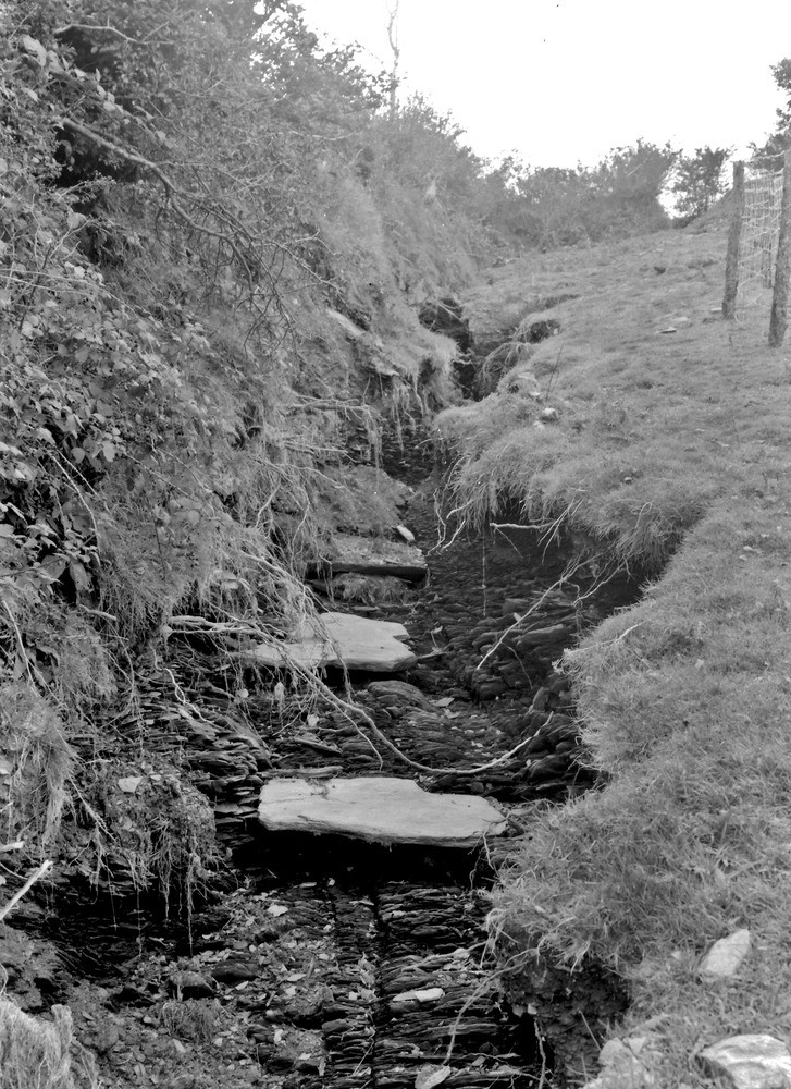
| Caption: | Challacombe - Simonsbath road (B 3358) at a point 25 yd. E. of spot height 1032 ft. about 1/2 m. from Challacombe. Looking N. |
| Description: | Challacombe - Simonsbath road (B 3358) at a point 25 yd. E. of spot height 1032 ft. about 1/2 m. from Challacombe. Looking N. North Exmoor floods, 1952. A view taken 64 yards south of the locality named, showing the site of a temporary stream formed by storm water that collected on the Challacombe-Simonsbath road. Note erosion in Ilfracombe Shales, also the gateway (in gap in hedge) through which the water escaped from the road. The white slabs are from the sandstone bands in the shale. See also A8760 and A8770. |
| Date taken: | Sun Oct 05 00:00:00 BST 1952 |
| Photographer: | Rhodes, J. |
| Copyright statement: | Crown |
| X longitude/easting: | 270500 |
| Y latitude/northing: | 140500 |
| Coordinate reference system, ESPG code: | 27700 (OSGB 1936 / British National Grid) |
| Orientation: | Portrait |
| Size: | 302.97 KB; 727 x 1000 pixels; 62 x 85 mm (print at 300 DPI); 192 x 265 mm (screen at 96 DPI); |
| Average Rating: | Not yet rated |
| Categories: | Unsorted Images, Geoscience subjects/ Landforms, river/ Floods |
Loading...
Loading...
Reviews
There is currently no feedback