| P number: | P208678 |
|---|---|
| Old photograph number: | A08756 |
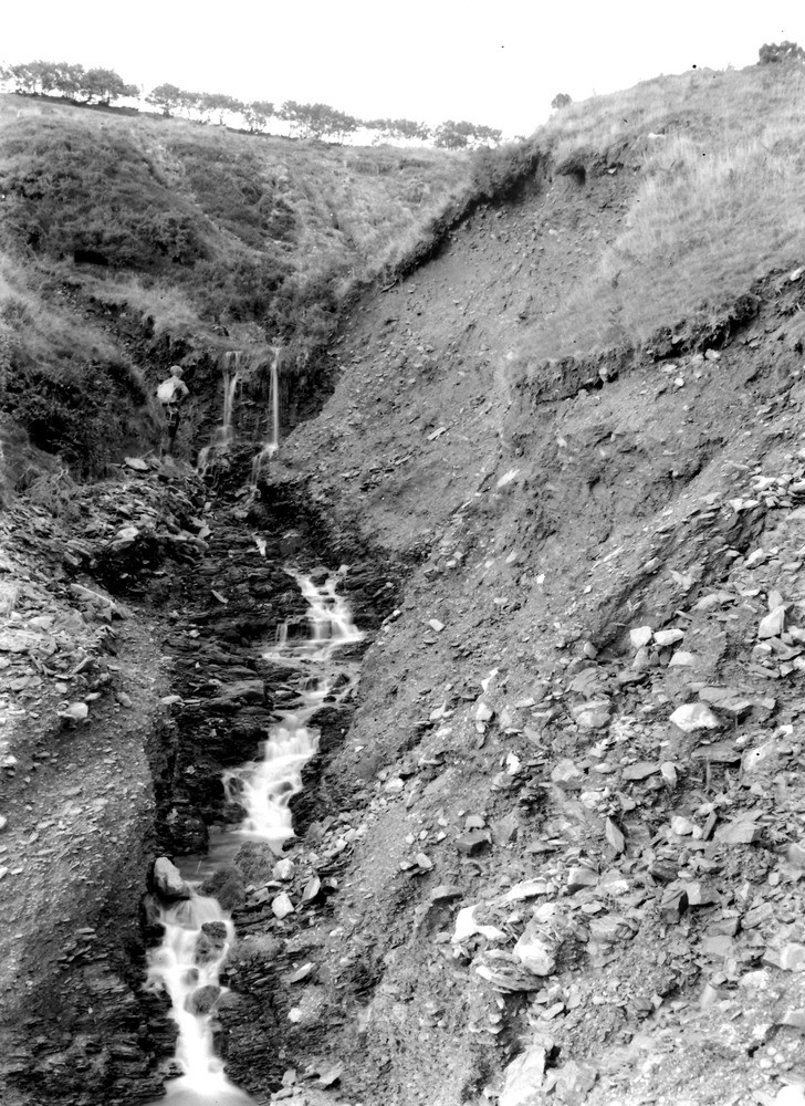
| Caption: | Near the top of Yarbury Combe, 950 yd. S. 33 degrees W. of Wood Barrow 1567 ft. (county boundary). Looking NNE. |
| Description: | Near the top of Yarbury Combe, 950 yd. S. 33 degrees W. of Wood Barrow 1567 ft. (county boundary). Looking NNE. North Exmoor floods, 1952. Intensive downcutting in head resting on shale (Ilfracombe Beds). The main ravine bends sharply round to the left just beyond the geologist. 215 yards downstream from A8752. |
| Date taken: | Fri Oct 03 00:00:00 BST 1952 |
| Photographer: | Rhodes, J. |
| Copyright statement: | Crown |
| X longitude/easting: | 271500 |
| Y latitude/northing: | 141500 |
| Coordinate reference system, ESPG code: | 27700 (OSGB 1936 / British National Grid) |
| Orientation: | Portrait |
| Size: | 315.64 KB; 728 x 1000 pixels; 62 x 85 mm (print at 300 DPI); 193 x 265 mm (screen at 96 DPI); |
| Average Rating: | Not yet rated |
| Categories: | Unsorted Images, Geoscience subjects/ Landforms, river/ Floods |
Loading...
Loading...
Reviews
There is currently no feedback