| P number: | P208676 |
|---|---|
| Old photograph number: | A08754 |
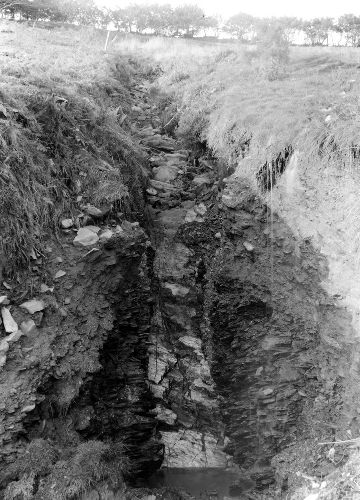
| Caption: | Head of Yarbury Combe, 675 yd. S. 38 degrees W. of Wood Barrow 1567 ft. (county boundary). Looking N. |
| Description: | Head of Yarbury Combe, 675 yd. S. 38 degrees W. of Wood Barrow 1567 ft. (county boundary). Looking N. North Exmoor floods, 1952. A waterfall shelf casued by hard sandstone overlying shale. Note intense downcutting in the shale, and thick head deposits. 35 yards downstream from A8752. |
| Date taken: | Fri Oct 03 00:00:00 BST 1952 |
| Photographer: | Rhodes, J. |
| Copyright statement: | Crown |
| X longitude/easting: | 271500 |
| Y latitude/northing: | 142500 |
| Coordinate reference system, ESPG code: | 27700 (OSGB 1936 / British National Grid) |
| Orientation: | Portrait |
| Size: | 287.27 KB; 721 x 1001 pixels; 61 x 85 mm (print at 300 DPI); 191 x 265 mm (screen at 96 DPI); |
| Average Rating: | Not yet rated |
| Categories: | Unsorted Images, Geoscience subjects/ Landforms, river/ Floods |
Loading...
Loading...
Reviews
There is currently no feedback