| P number: | P208675 |
|---|---|
| Old photograph number: | A08753 |
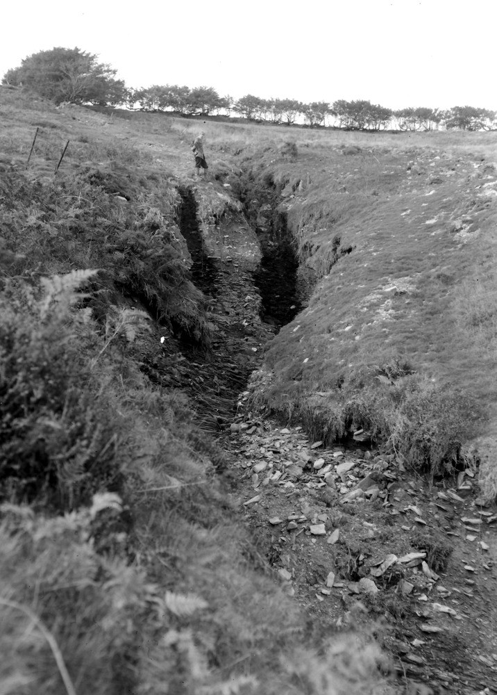
| Caption: | Head of Yarbury Combe, 725 yd. S. 35 degrees W. of Wood Barrow 1567 ft. (county boundary). Looking N. (approx). |
| Description: | Head of Yarbury Combe, 725 yd. S. 35 degrees W. of Wood Barrow 1567 ft. (county boundary). Looking N. (approx). North Exmoor floods, 1952. Intense erosion in head and Ilfracombe Shale. 80 yards downstream from A8752. |
| Date taken: | Fri Oct 03 00:00:00 BST 1952 |
| Photographer: | Rhodes, J. |
| Copyright statement: | Crown |
| X longitude/easting: | 271500 |
| Y latitude/northing: | 141500 |
| Coordinate reference system, ESPG code: | 27700 (OSGB 1936 / British National Grid) |
| Orientation: | Portrait |
| Size: | 230.59 KB; 716 x 1000 pixels; 61 x 85 mm (print at 300 DPI); 189 x 265 mm (screen at 96 DPI); |
| Average Rating: | Not yet rated |
| Categories: | Unsorted Images, Geoscience subjects/ Landforms, river/ Floods |
Loading...
Loading...
Reviews
There is currently no feedback