| P number: | P208657 |
|---|---|
| Old photograph number: | A08735 |
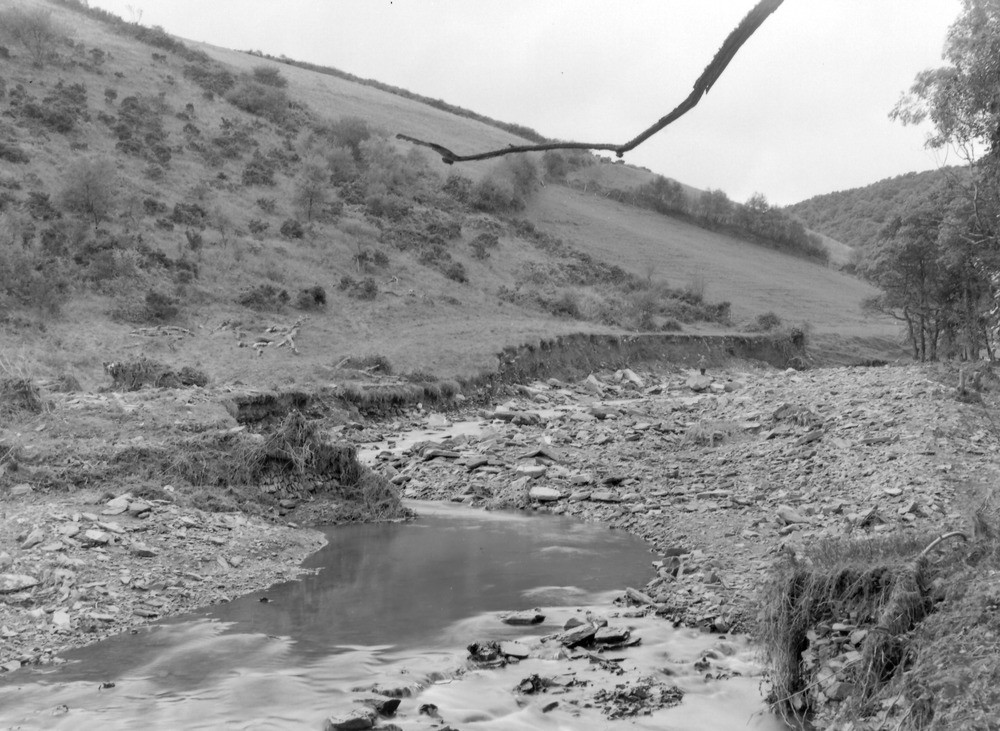
| Caption: | Hoaroak Water, 675 yd. NW of Cheriton. Looking SW (upstream). |
| Description: | Hoaroak Water, 675 yd. NW of Cheriton. Looking SW (upstream). North Exmoor floods, 1952. The river originally flowed along the edge of the wood (right margin). The boulder spread is at least 3 ft. thick and probably much more in places. The new cliff exposure shows about 12 ft. of loamy head resting on Hangman Grit in places. |
| Date taken: | Tue Oct 07 00:00:00 BST 1952 |
| Photographer: | Rhodes, J. |
| Copyright statement: | Crown |
| X longitude/easting: | 273500 |
| Y latitude/northing: | 147500 |
| Coordinate reference system, ESPG code: | 27700 (OSGB 1936 / British National Grid) |
| Orientation: | Landscape |
| Size: | 231.79 KB; 1000 x 731 pixels; 85 x 62 mm (print at 300 DPI); 265 x 193 mm (screen at 96 DPI); |
| Average Rating: | Not yet rated |
| Categories: | Unsorted Images, Geoscience subjects/ Landforms, river/ Floods |
Loading...
Loading...
Reviews
There is currently no feedback