| P number: | P208653 |
|---|---|
| Old photograph number: | A08731 |
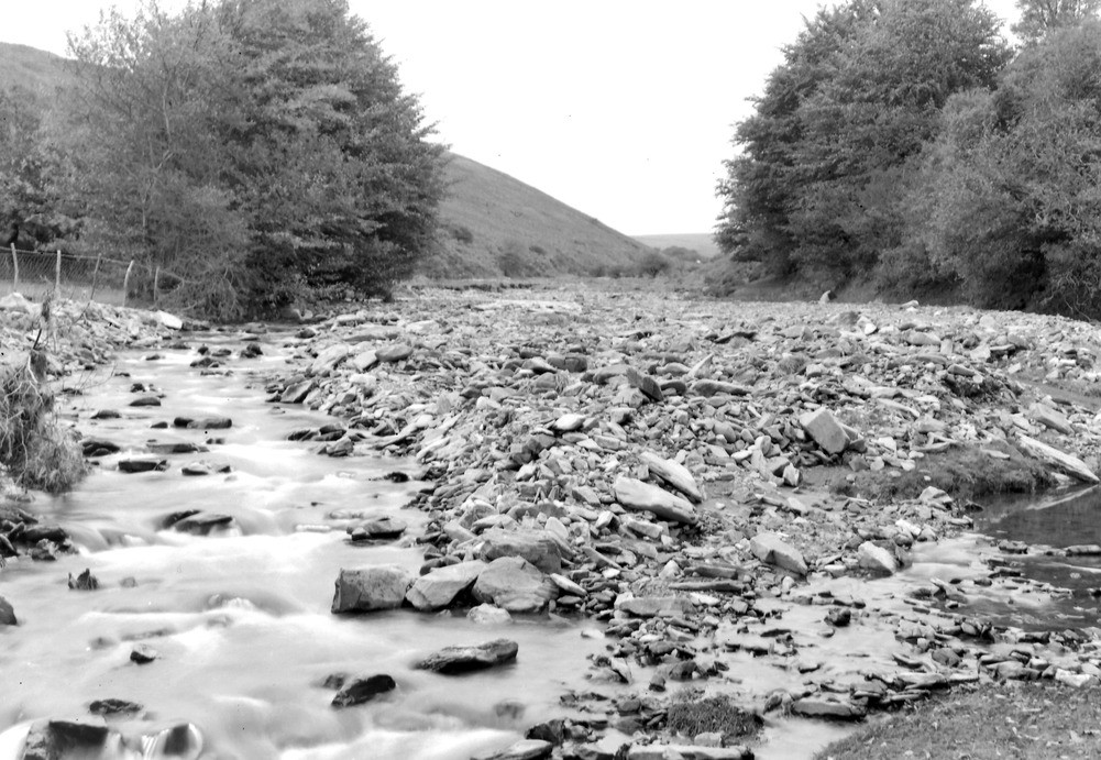
| Caption: | Hoaroak Water, 1,175 yd. SW of Farley. Looking NE (downstream). |
| Description: | Hoaroak Water, 1,175 yd. SW of Farley. Looking NE (downstream). North Exmoor floods, 1952. Widespread gravel and boulder deposits. The original curve of the river was on the extreme right along the bottom of the steep wooded slope. Slightly different view to A8716. |
| Date taken: | Tue Oct 07 00:00:00 BST 1952 |
| Photographer: | Rhodes, J. |
| Copyright statement: | Crown |
| X longitude/easting: | 273500 |
| Y latitude/northing: | 145500 |
| Coordinate reference system, ESPG code: | 27700 (OSGB 1936 / British National Grid) |
| Orientation: | Landscape |
| Size: | 246.37 KB; 1001 x 691 pixels; 85 x 59 mm (print at 300 DPI); 265 x 183 mm (screen at 96 DPI); |
| Average Rating: | Not yet rated |
| Categories: | Unsorted Images, Geoscience subjects/ Landforms, river/ Floods |
Loading...
Loading...
Reviews
There is currently no feedback