| P number: | P208641 |
|---|---|
| Old photograph number: | A08719 |
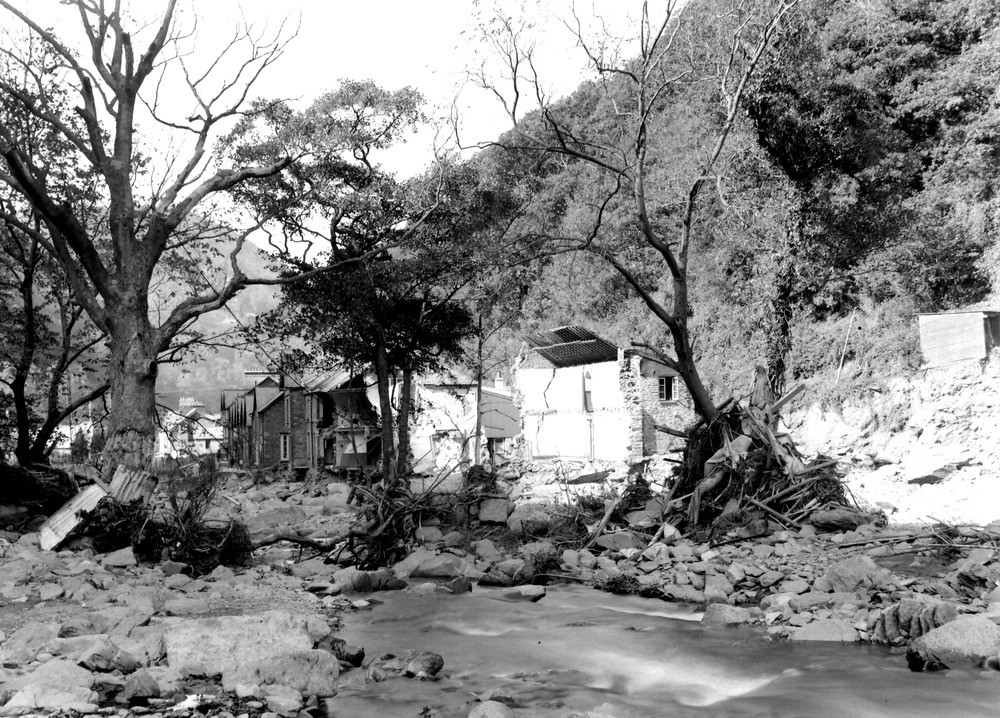
| Caption: | East Lyn, 470 yd. ESE of East Lyn (Lyndale A 39) Bridge, Lynmouth. Looking WNW (downstream). |
| Description: | East Lyn, 470 yd. ESE of East Lyn (Lyndale A 39) Bridge, Lynmouth. Looking WNW (downstream). North Exmoor floods, 1952. The debris piled against the trees is remains of houses washed away about 50 yards upstream. (Note head cliff on the right underneath the hut.) |
| Date taken: | Wed Oct 08 00:00:00 BST 1952 |
| Photographer: | Rhodes, J. |
| Copyright statement: | Crown |
| X longitude/easting: | 272500 |
| Y latitude/northing: | 149500 |
| Coordinate reference system, ESPG code: | 27700 (OSGB 1936 / British National Grid) |
| Orientation: | Landscape |
| Size: | 345.21 KB; 1000 x 718 pixels; 85 x 61 mm (print at 300 DPI); 265 x 190 mm (screen at 96 DPI); |
| Average Rating: | Not yet rated |
| Categories: | Unsorted Images, Geoscience subjects/ Landforms, river/ Floods |
Loading...
Loading...
Reviews
There is currently no feedback