| P number: | P208639 |
|---|---|
| Old photograph number: | A08717 |
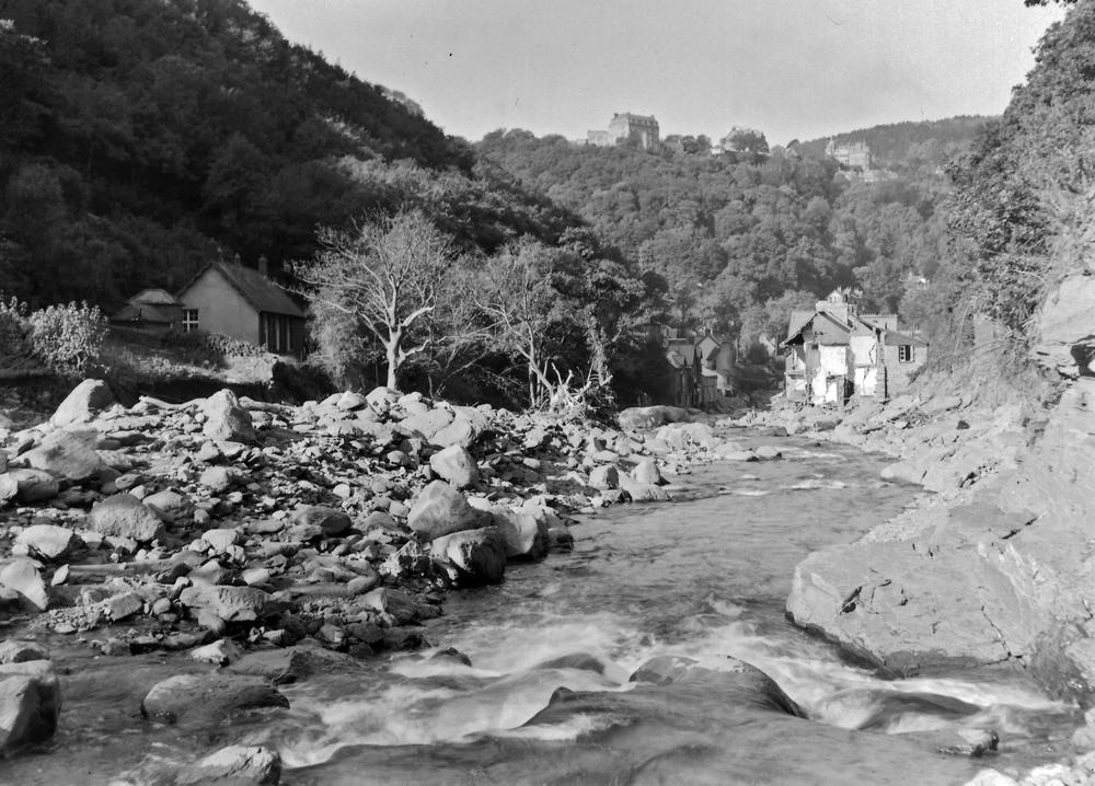
| Caption: | East Lyn, 530 yd. ESE of East Lyn (Lyndale A 39) Bridge, Lynmouth. Looking WNW (downstream). |
| Description: | East Lyn, 530 yd. ESE of East Lyn (Lyndale A 39) Bridge, Lynmouth. Looking WNW (downstream). North Exmoor floods, 1952. Outskirts of Lynmouth. The end houses of the terrace (right) were washed away. Lynton Beds outcrop on the extreme right. The pile of boulders on the left are on the site of a row of demolished houses. (A8716) shows a slightly different view. Lynton is seen perched on top of the wooded hill. |
| Date taken: | Wed Oct 08 00:00:00 BST 1952 |
| Photographer: | Rhodes, J. |
| Copyright statement: | Crown |
| X longitude/easting: | 272500 |
| Y latitude/northing: | 149500 |
| Coordinate reference system, ESPG code: | 27700 (OSGB 1936 / British National Grid) |
| Orientation: | Landscape |
| Size: | 251.50 KB; 1000 x 718 pixels; 85 x 61 mm (print at 300 DPI); 265 x 190 mm (screen at 96 DPI); |
| Average Rating: | Not yet rated |
| Categories: | Unsorted Images, Geoscience subjects/ Landforms, river/ Floods |
Loading...
Loading...
Reviews
There is currently no feedback