| P number: | P208629 |
|---|---|
| Old photograph number: | A08707 |
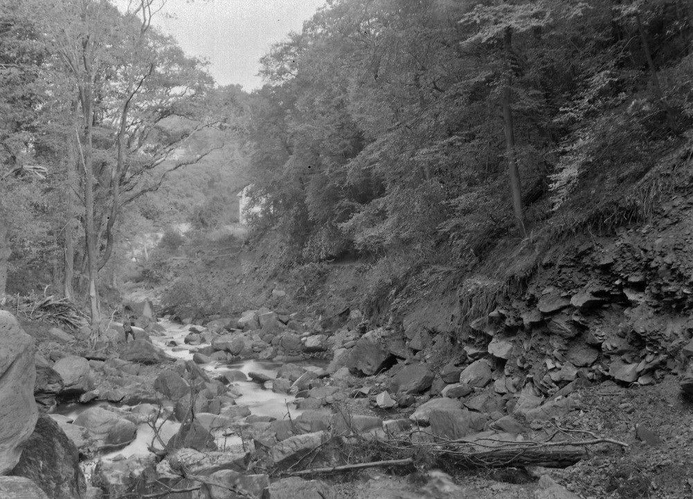
| Caption: | West Lyn Gorge, 450 yd. SSW of West Lyn Bridge (A 39), Lynmouth (same location as A8701). Looking N. (downstream). |
| Description: | West Lyn Gorge, 450 yd. SSW of West Lyn Bridge (A 39), Lynmouth (same location as A8701). Looking N. (downstream). North Exmoor floods, 1952. General view of the West Lyn gorge showing boulder-choked bed and intense undercutting of head in its sides. |
| Date taken: | Mon Oct 06 00:00:00 BST 1952 |
| Photographer: | Rhodes, J. |
| Copyright statement: | Crown |
| X longitude/easting: | 272500 |
| Y latitude/northing: | 149500 |
| Coordinate reference system, ESPG code: | 27700 (OSGB 1936 / British National Grid) |
| Orientation: | Landscape |
| Size: | 266.20 KB; 1001 x 721 pixels; 85 x 61 mm (print at 300 DPI); 265 x 191 mm (screen at 96 DPI); |
| Average Rating: | Not yet rated |
| Categories: | Unsorted Images, Geoscience subjects/ Landforms, river/ Floods |
Loading...
Loading...
Reviews
There is currently no feedback