| P number: | P208618 |
|---|---|
| Old photograph number: | A08696 |
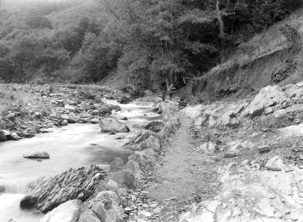
| Caption: | West Lyn River, 320 yd. SW of the river bridge at Lynbridge. Looking W. (upstream). |
| Description: | West Lyn River, 320 yd. SW of the river bridge at Lynbridge. Looking W. (upstream). North Exmoor floods, 1952. West Lyn gorge. A cliff of head caused by severe undercutting of the river. The geologist is standing on a water filter while the associated pipeline is under the rebuilt stone-edged path. The flood destroyed both the filter and the pipeline, sweeping the head etc. off the solid rock (Lynton Beds) which is seen in the river bed and to the right of the pathway. A small landslip is seen about 50 yards beyond the geologist. |
| Date taken: | Thu Oct 02 00:00:00 BST 1952 |
| Photographer: | Rhodes, J. |
| Copyright statement: | Crown |
| X longitude/easting: | 271500 |
| Y latitude/northing: | 148500 |
| Coordinate reference system, ESPG code: | 27700 (OSGB 1936 / British National Grid) |
| Orientation: | Landscape |
| Size: | 283.47 KB; 1000 x 733 pixels; 85 x 62 mm (print at 300 DPI); 265 x 194 mm (screen at 96 DPI); |
| Average Rating: | Not yet rated |
| Categories: | Unsorted Images, Geoscience subjects/ Landforms, river/ Floods |
Loading...
Loading...
Reviews
There is currently no feedback